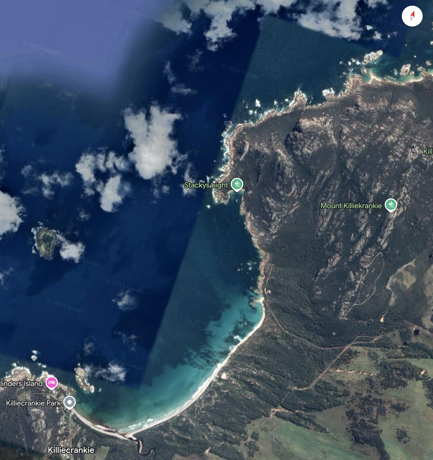
Killiecrankie Bay is on the northwestern side of Flinders Island.
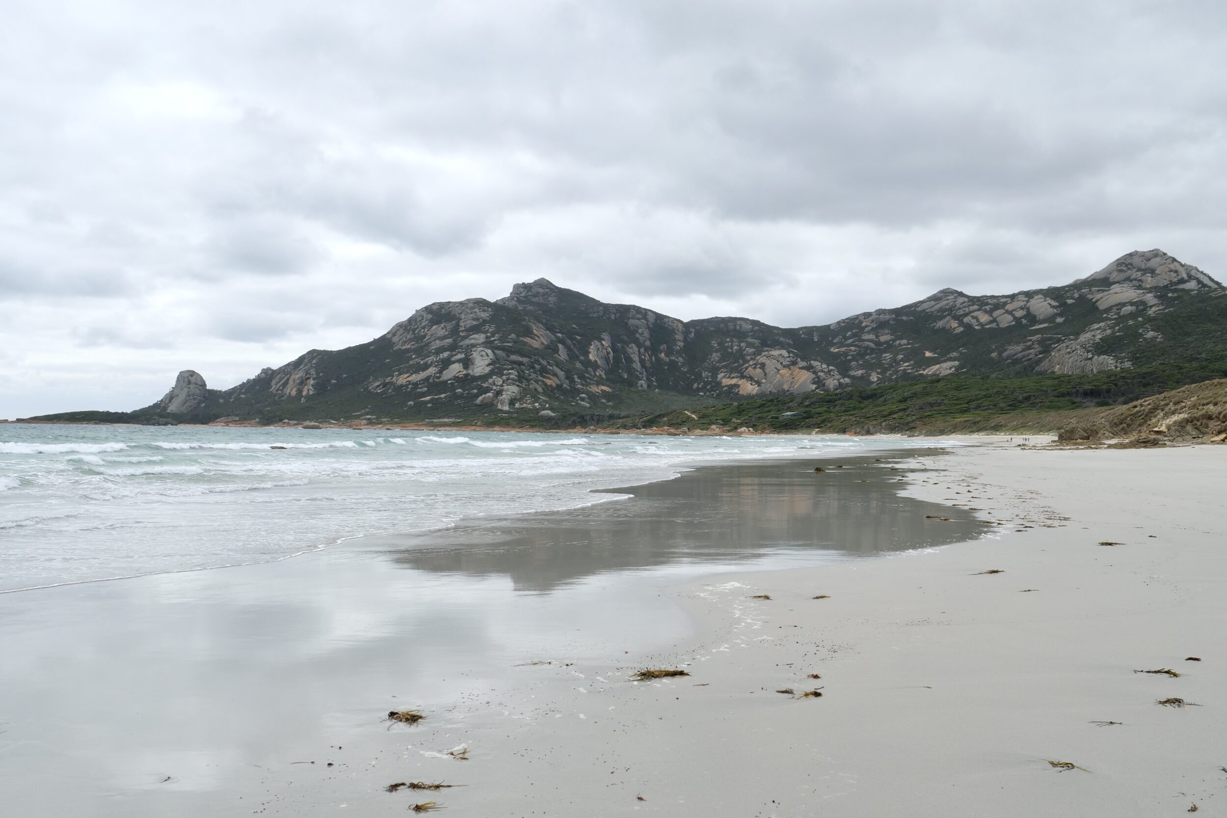
Both of this post’s photos offer a wide angle view (32 mm).
The featured image looks north, from the southern half of the bay’s shoreline.
Its high point – Mount Killiecrankie – rises circa 316 metres above sea level.
(Alleged altitude readings for Flinders Island’s peaks are highly unreliable/inconsistent. Some add another couple of metres to Mt Killiecrankie. Others lop 30 metres off it!)
The rocky outcrop on left side of the featured image is Old Man’s Head.
We were very much closer to the old man when I took this photo:
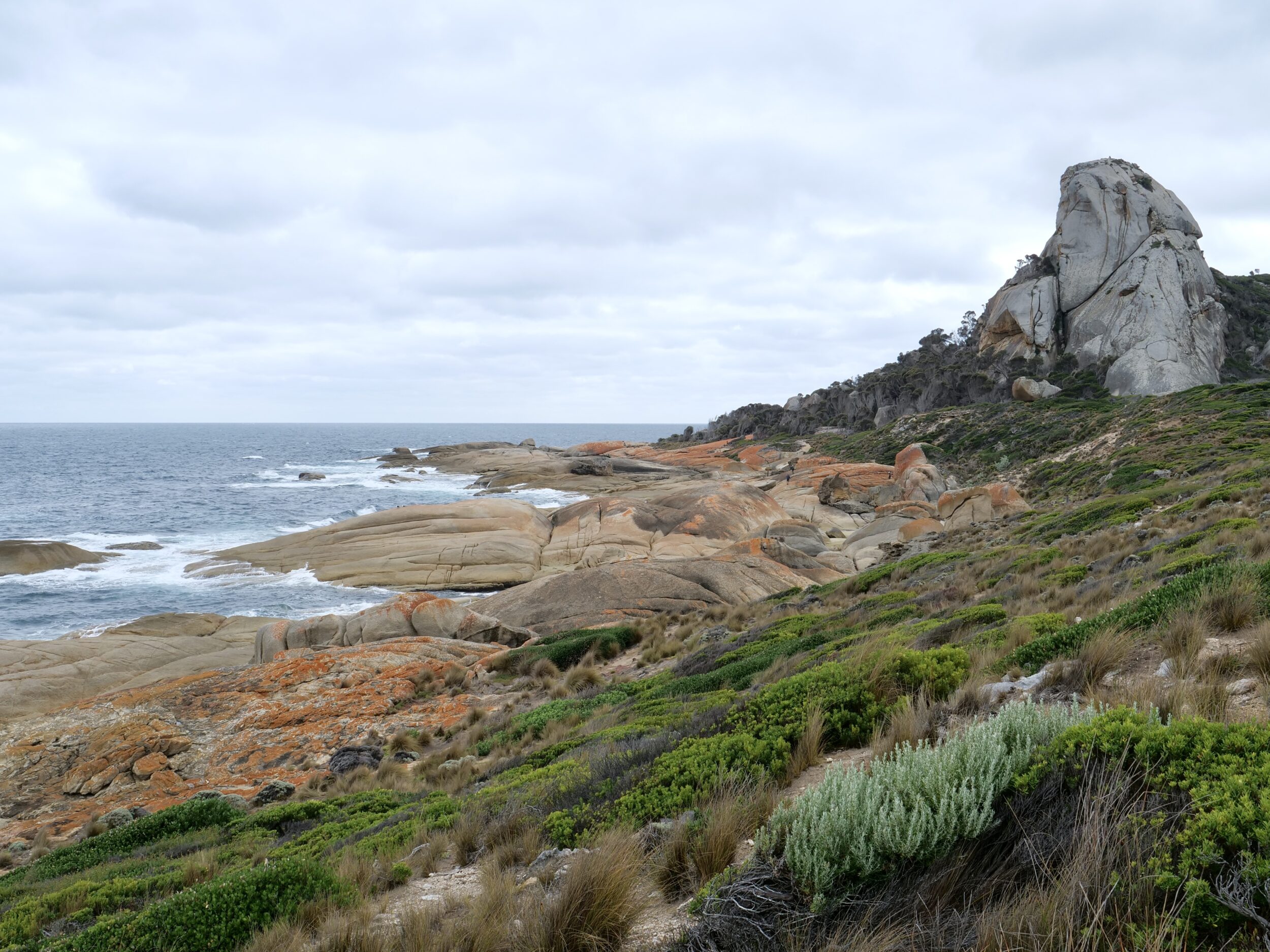
Old Mans Head is still the star attraction in the next post.
That will illustrate just how variable the “same thing” can look, depending on changes in light, proximity, angle of view and lenses’ focal length.
In the mid 20th century Killiecrankie-based professional fishers harvested a great many lobsters.
Now, just one boat is licensed to catch “crays” in Killiecrankie Bay.
(recreational fishers still catch and consume a few lobsters)
Killiecrankie is also known for the so-called “Killiecrankie diamonds” (which are actually topaz) and for its natural beauty.
Discover more here.