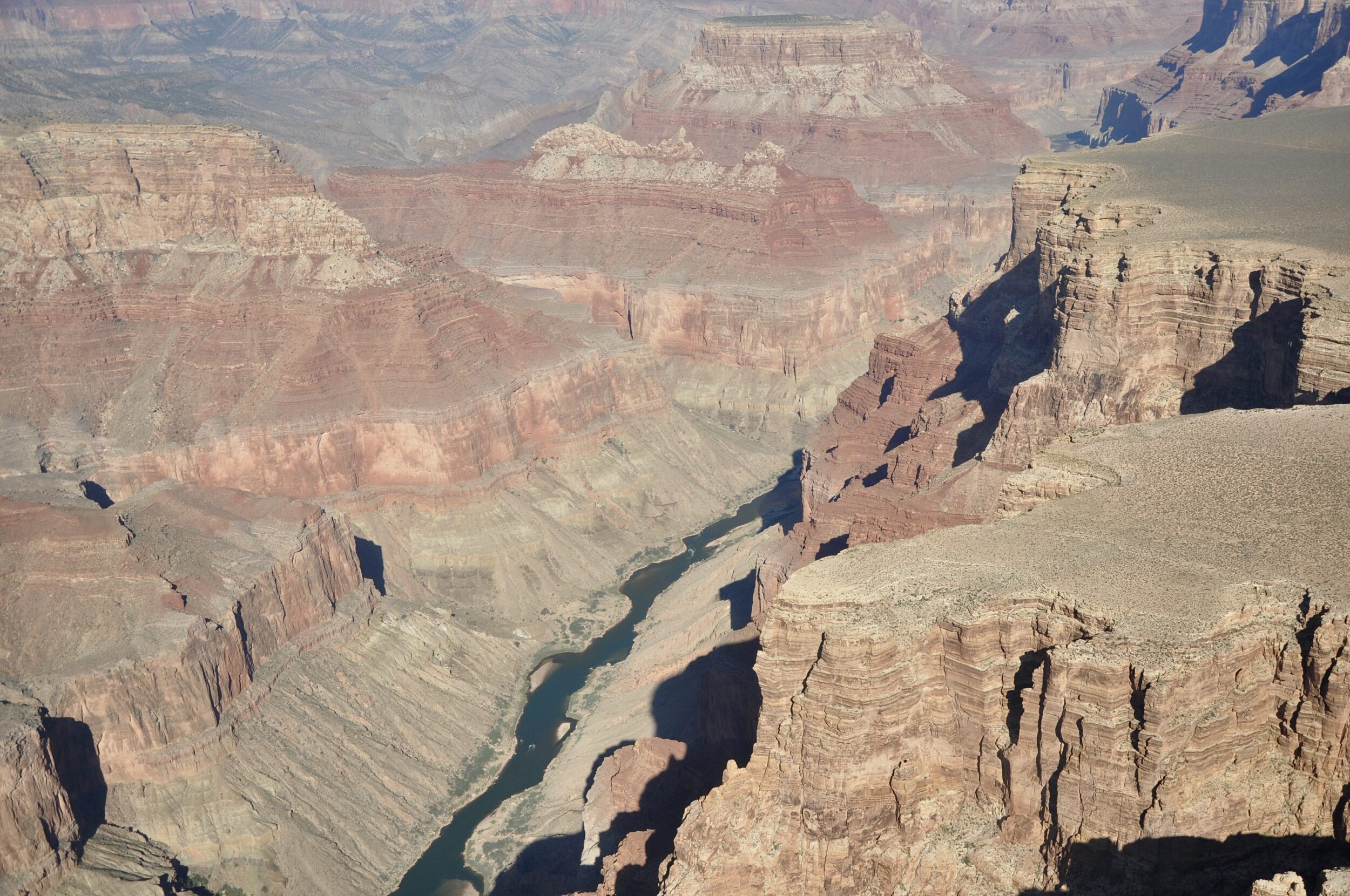
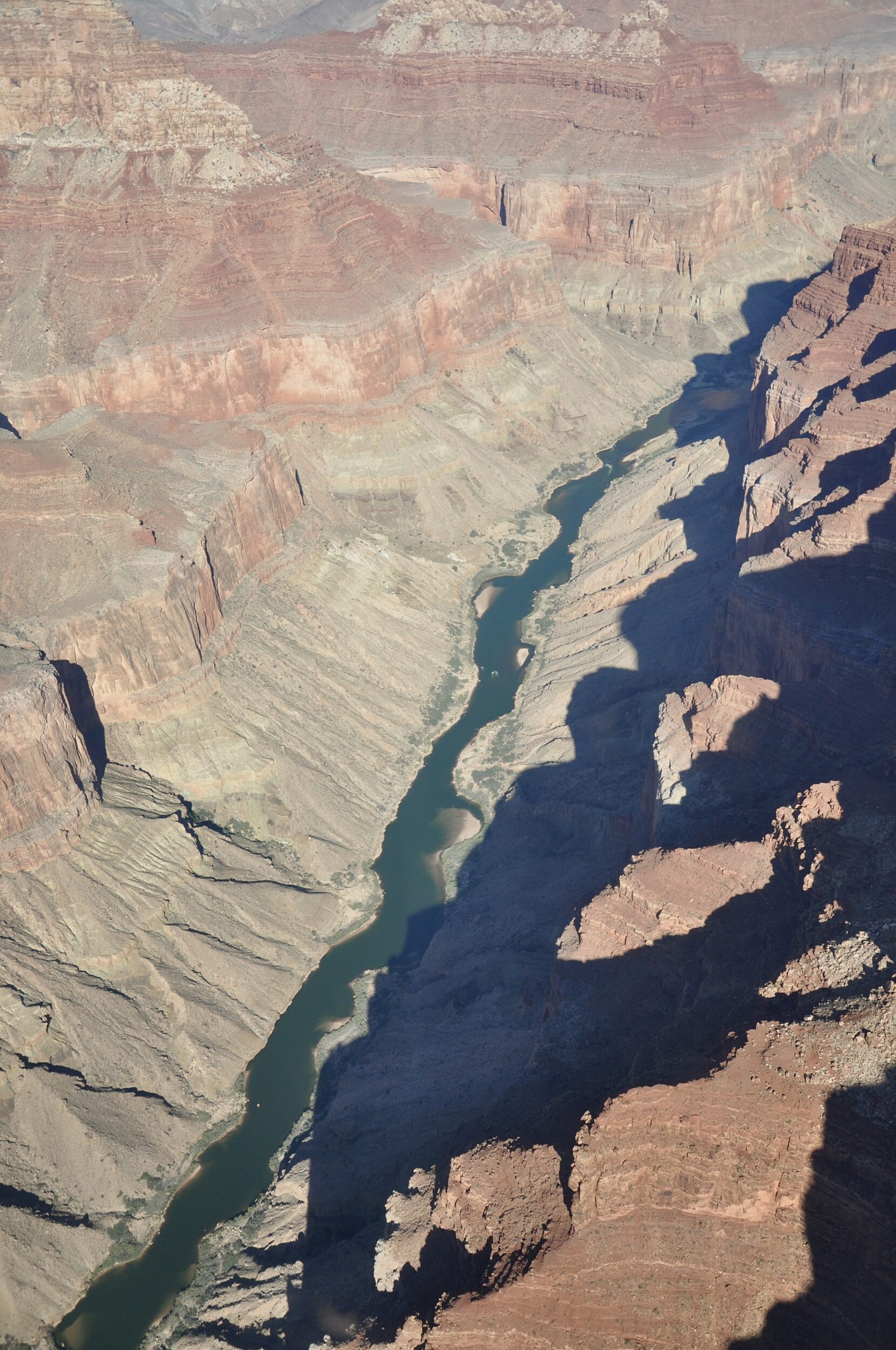
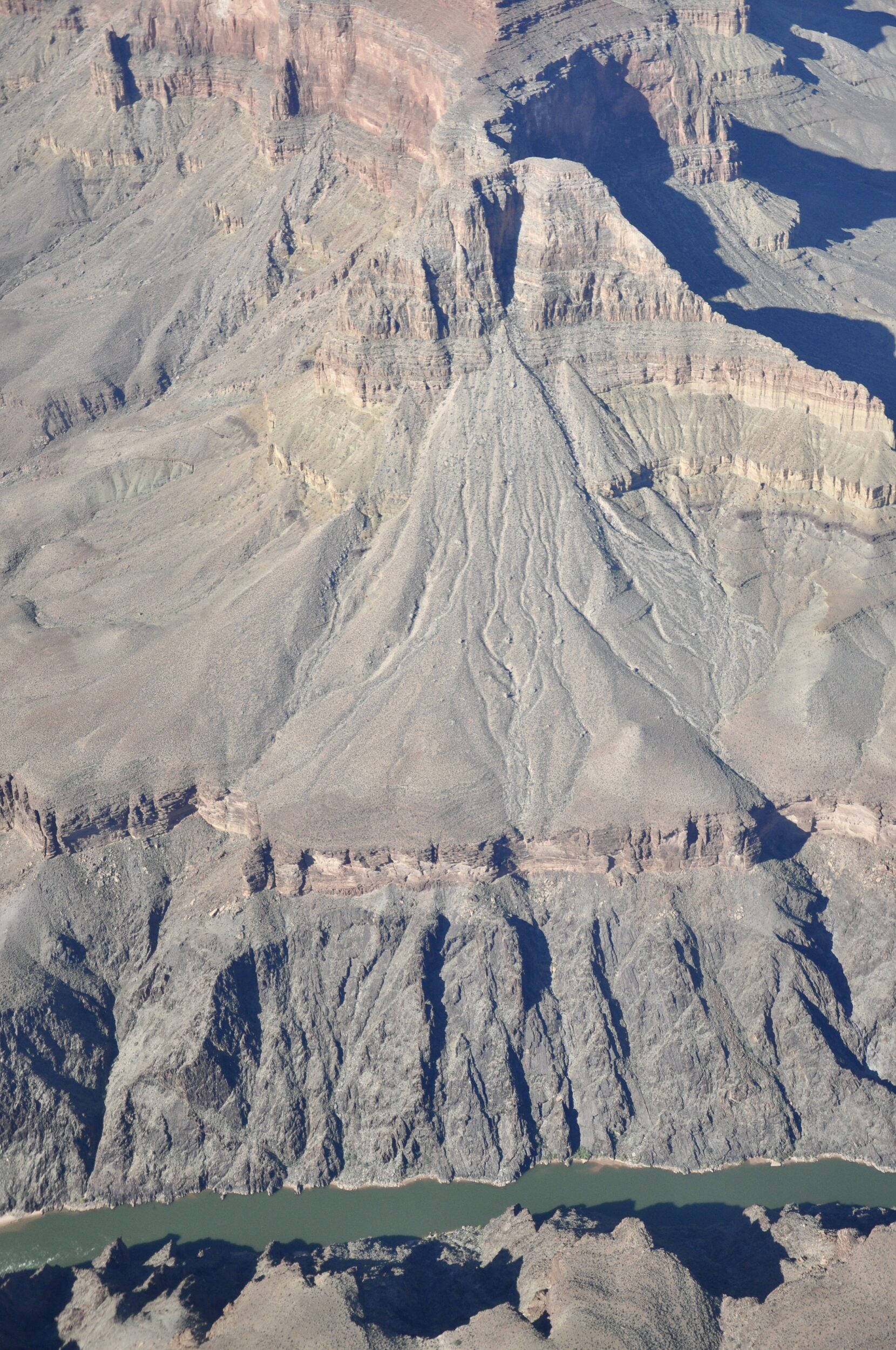
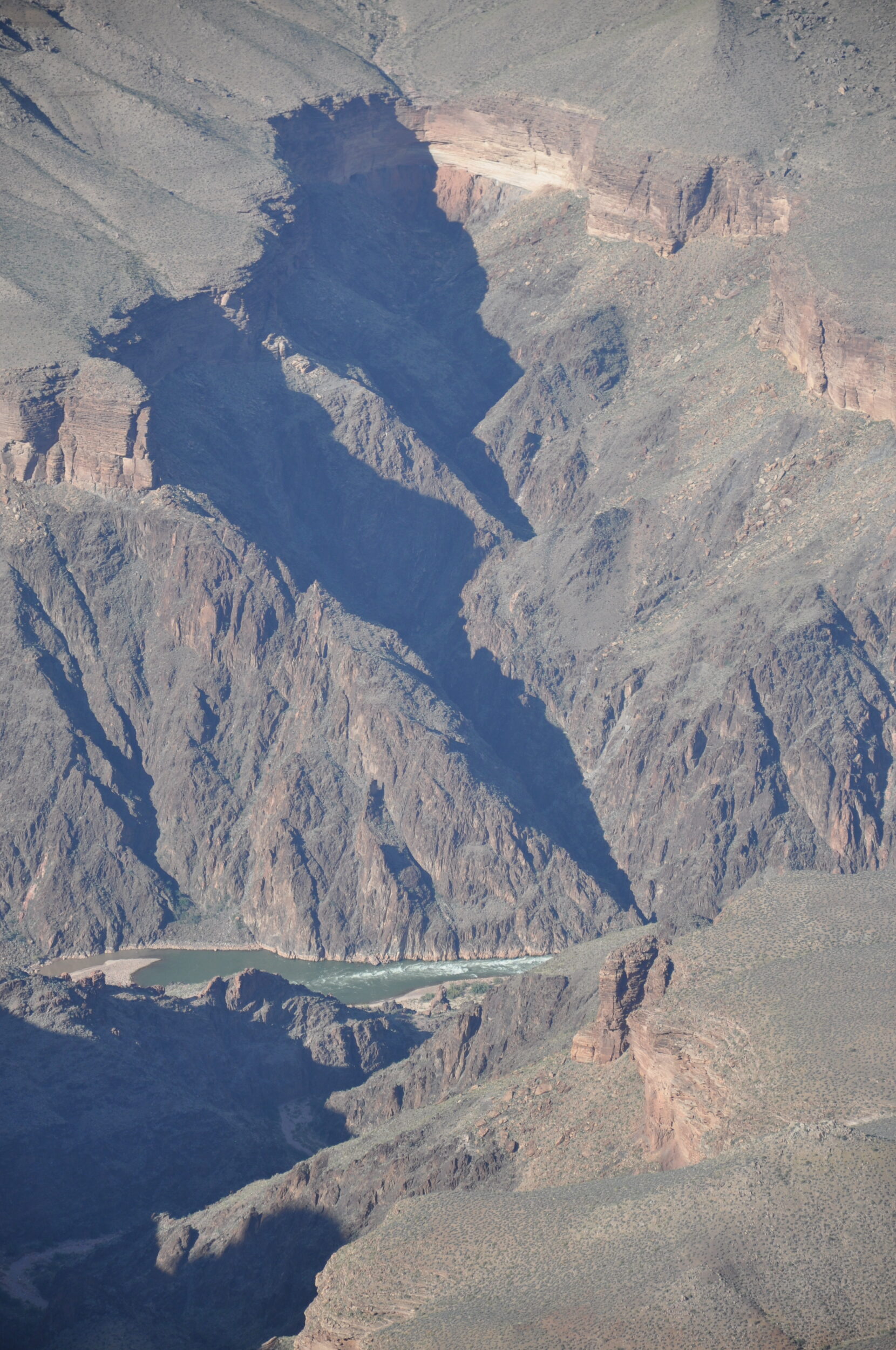
The first three of this post’s four photos were all taken from a helicopter, looking down into the Grand Canyon.
That canyon’s “lead author” runs along its “floor” – the Colorado River.
As the Colorado’s excellent Wikipedia entry notes, the United States’ fifth-longest river is one of the most controlled and litigated river systems in the world.
This once-wild, formerly much-mightier river has become an ailing shadow of its former self; irrigators and thirsty cities have tamed, maimed and nearly drained it.
Notionally, the Colorado runs for 2,330 kilometres.
In its lowest reaches, however, the Colorado now rarely runs at all.
Most of the time, it no longer contributes to its once-mighty delta on the shores of Mexico’s “Gulf of California”/ aka “Sea of Cortez”.
Historically, the Colorado transported from 85 to 100 million short tons (77,000,000 to 91,000,000 t) of sediment or silt to the Gulf of California each year – second only to the Mississippi among North American rivers.[309] This sediment nourished wetlands and riparian areas along the river’s lower course, particularly in its 3,000-square-mile (7,800 km2) delta, once the largest desert estuary on the continent.[310] Currently, the majority of sediments carried by the Colorado River are deposited at the upper end of Lake Powell
(The italicised quotations are from the aforementioned Wikipedia entry)
Historically, the delta with its large freshwater outflow and extensive salt marshes provided an important breeding ground for aquatic species in the Gulf. Today’s desiccated delta, at only a fraction of its former size, no longer provides suitable habitat, and populations of fish, shrimp and sea mammals in the gulf have seen a dramatic decline.[197] Since 1963, the only times when the Colorado River has reached the ocean have been during El Niño events in the 1980s and 1990s.[314]
The Grand Canyon’s very existence is evidence of how much more powerful the Colorado once was.
A helicopter flight affords an array of vistas and perspectives that are not available from the canyon’s rim.
That said, the canyon’s grandeur is inescapably apparent to all visitors, including those whose feet remain on the ground.
The photo below was taken from the South Rim on the previous afternoon.
From the South Rim to the Colorado, the vertical “drop” is circa 1.6 kilometres.
Footnote (in response to John’s comment, below)
The short answer to John’s first question is “yes”.
Answers to some of the others are contested/contestable.
Our collective “understanding” of the Grand Canyon’s age, formation, and likely future has been “evolving” at a rapid rate. Tectonic activity is the key to the canyon’s formation; it was not simply “the mighty Colorado’s erosive ability”. The key event was a surprisingly “recent” uplift of the plateau in which the canyon sits.
Geological/geomorphological processes have been in play for an enormously long time, but the Grand Canyon’s present, prodigiously-spectacular dimensions are much more “youthful”, geologically, than most people imagine. Australia has some much older canyons, and watercourses which were already “in place” long before the Colorado was born.
Click here for a good, succinct overview of the Grand Canyon’s past, present & future.
Is this also a grand example of excess drainage not naturally offset by inflow. regenerating the outflow? Also historically, what state were the rims and beyond to cause such canyon erosion and sediment travel in first place? Parallels in Australia where once wonderful rivers now eroded drainage channels were beneficial chains of ponds serving flood plains. How many thousands of people are drawn to the present Canyon spectacle without any consideration of broader, deeper aspects/lessons?
Enjoy your Colombia adventures, John