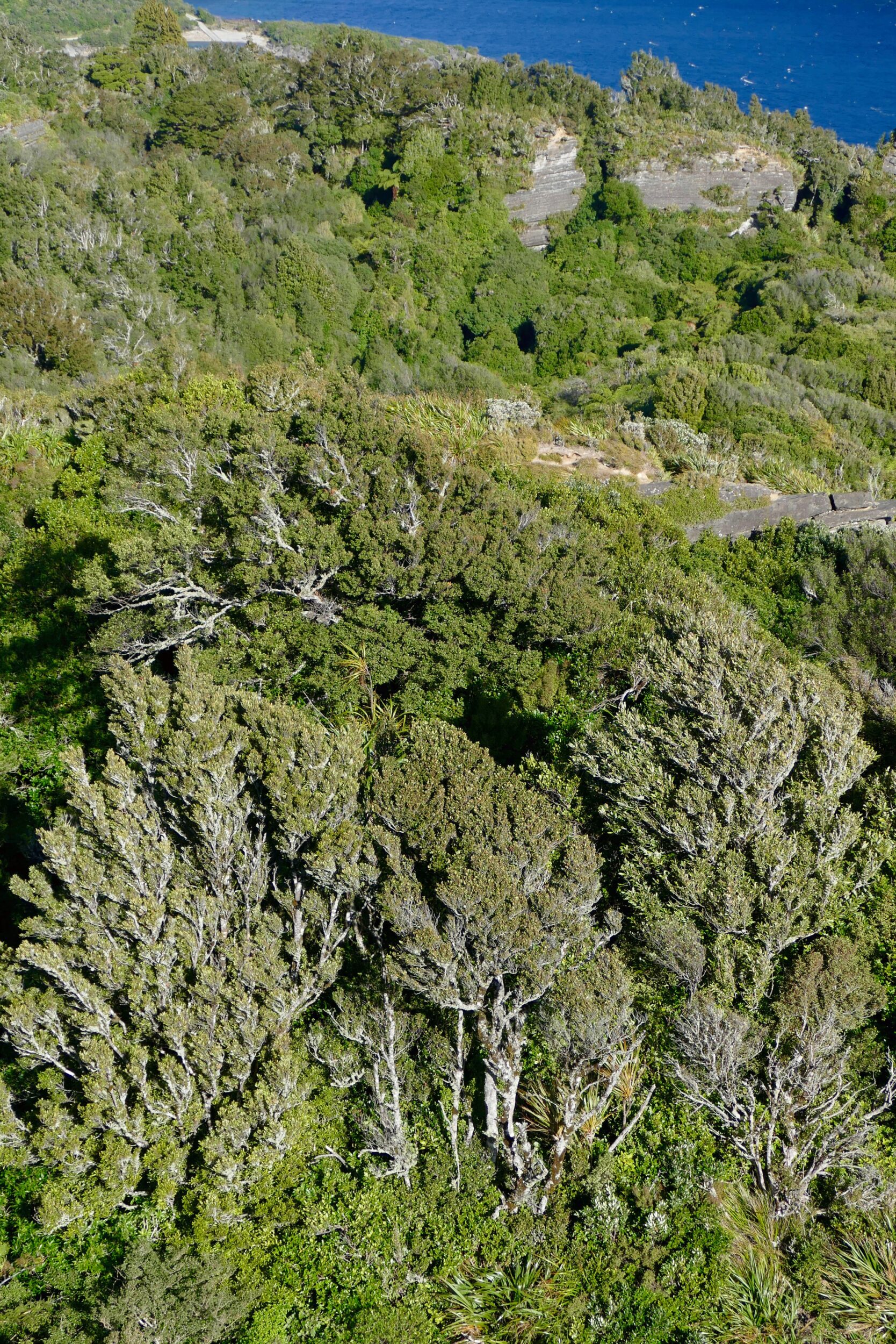
This post’s featured image is another example of how remarkably “different” trees and forests can appear when one is able to look down on them…literally.
I took the above photo from a hilltop/outcrop near the edge of the deepest lake on New Zealand’s North Island.
At 54 square kilometres, Waikaremoana it is that island’s fourth largest lake by surface area, but is #2 in water volume. (#1, in both respects on the North Island, is Lake Taupo. Taupo has the largest surface of any NZ lake. Several of the South Island’s glacially-gouged lakes contain more water)
Waikaremoana is very beautiful, but sees remarkably few tourists, thanks to its “remote” location.
Most of the lake’s rugged surrounds have temperate rainforests that have never been logged.
An astonishing fact: until circa 2,200 years ago this lake simply did not exist!
It was created – almost certainly, via an earthquake – by massive landslips..
…around the time that Hannibal was crossing the Alps, the Romans were building the first sundial and the Chinese were inventing tofu—something dramatic happened. Two landslides carrying millions of tonnes of fractured sandstone and siltstone swept down from the mountains, converging to produce a wedge some eight kilometres long and four kilometres wide that blocked what is now the Waikaretaheke River. Slowly and steadily the valleys backfilled with water, producing a lake that is 256 metres at its deepest point.
The italicised quotation is from Deep History – an excellent, article which explains the lake’s origins & shows the “drowned” forests which still lurk on Waikaremoana’s floor.
Deep History also explores present-day management “issues”, in both “nature conservation” and “cultural” terms. Click here for the full, well-illustrated text.
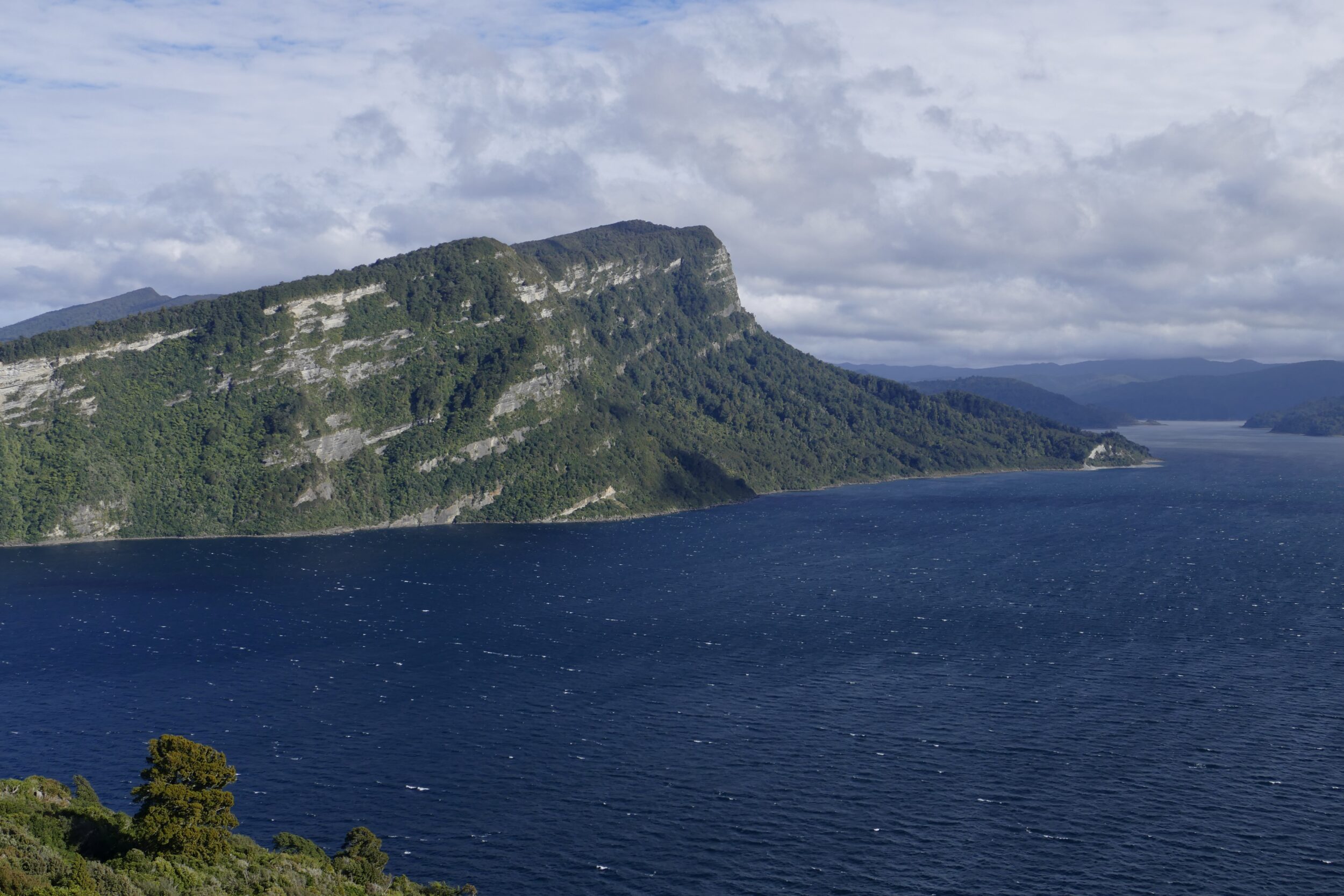
This post’s featured image & the one immediately below were both taken from the same vantage point, late on the morning of 06 May 2015.
My photo shows the most dramatic landform on the lake’s southern shore.
Waikaremoana’s surface is a whisker under 600 metres above sea level; Panekiri Bluff, rises very nearly another 600 metres above the lake.
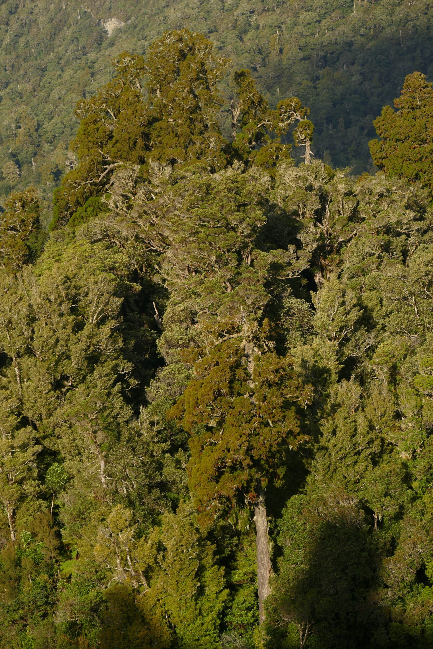
My beloved & I spent most of the afternoon of 15 May 2015 walking through virgin rainforest, en route to & from a smaller, higher altitude lake.
That forest includes some of New Zealand’s tallest trees.
The photo below took crucial advantage of two things.
Firstly, at 4.32 pm, sunset was nigh; the “golden hour” light was lovely, as were the lengthening-shadows.
Secondly, we were on one steep slope, looking across to another; although the top of the tallest tree on the opposite slope soared high above, that tree’s base was well below us.
Photographically, this was a happy combination of circumstances.
Our particular vantage point greatly enhanced my ability to convey the forest’s “verticality”, without having to pay a high “distortion price”.
And being blessed with “golden hour light, and the sun behind me” made it uncommonly easy to expose most – rather than only one particular bit – of a forested landscape, “correctly”.
Comments