The pictured location is not in the Atlas Mountains, but is in Morocco.
Morocco’s northernmost mountain range rises to 2,456 metres above sea level – a deal more modest than the Atlas, but still 228 metres higher than the Australian continent’s high point.
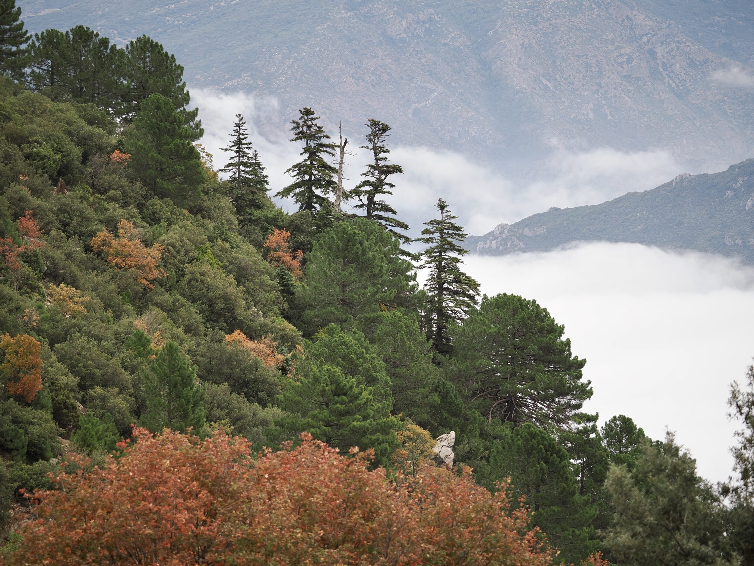
The Rif Mountains’ western end is very much wetter than is any other part of Morocco.
In most winters the Rif’s upper slopes are probably the nation’s snowiest; at any time of year they offer dramatic vistas and some beautiful (albeit threatened/remnant) forests.
The Rif is “very Moroccan”, but its wetter, higher parts do not at all resemble most visitors’ preconceptions of what Morocco “should” look like.
I took the photo on an autumn afternoon in late October.
My vantage point’s altitude was probably circa 1900 metres ASL – similiar to Victoria’s “roof”.
Here, venerable African cedars soar above other conifers and an understorey of deciduous trees and hardy bushes.
To reach this location one needs to hire a guide, plus a 4WD with a capable driver who is very familiar with local roads and weather conditions.
That done, a wonderful, non-stressful afternoon’s adventure is easily-enjoyed in these mountains, as future multi-image posts will illustrate.
Chefchaouen felt “a million miles away”, but the drive back (down, down, down…) to the “blue city” only took an hour or so.