Kaikoura is the name of a peninsula, the town thereon, two spectacular mountain ranges, and a hugely “productive”, very deep marine canyon.
The aforementioned all sit within the compact region of the same name, on/off the east coast of New Zealand’s South Island; “kaikoura’ is a Māori term which means “to eat crayfish/”.
(the local “crayfish”/lobsters are excellent, albeit pricey, and they are “in season” year-round)
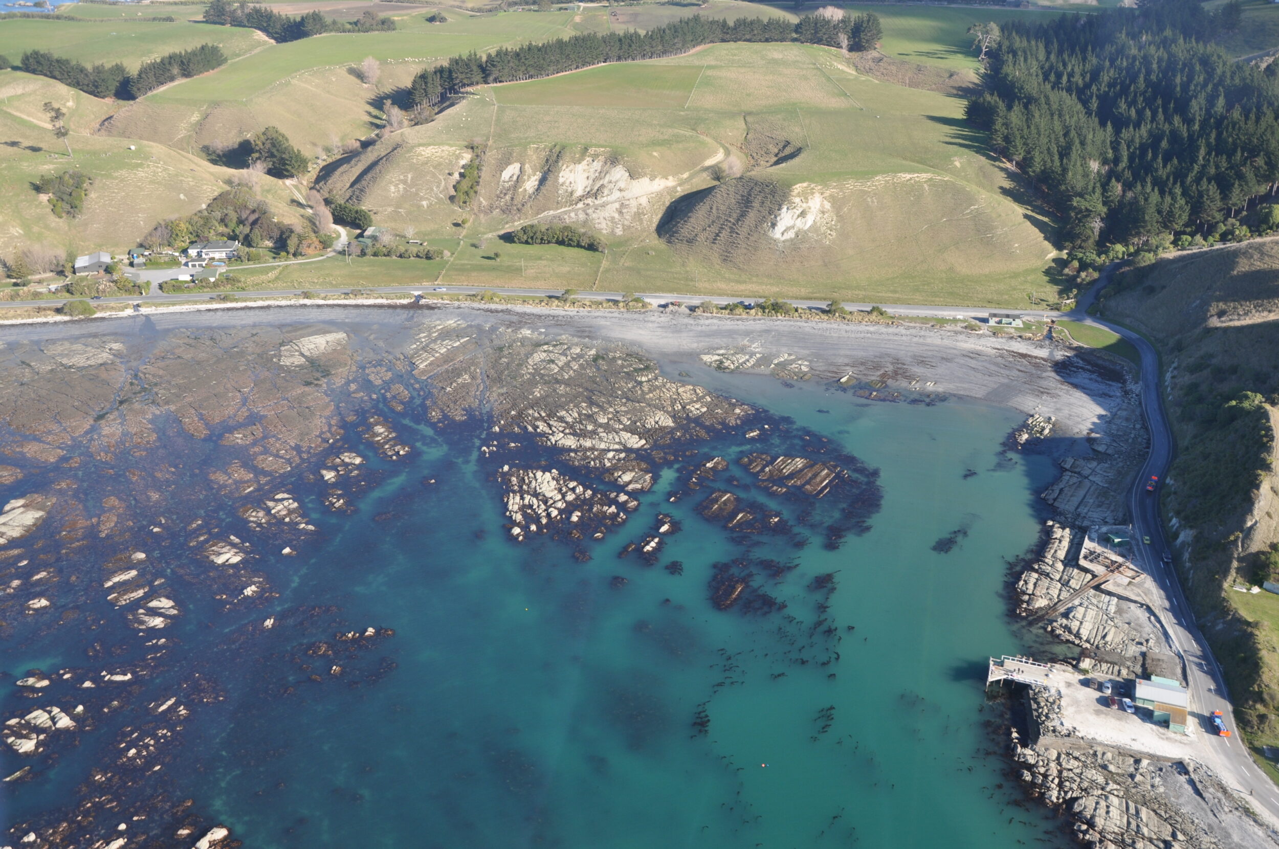
The Kaikoura Peninsula protrudes five kilometres into the Pacific Ocean, and is noted for the remains of Māori forts, atop…and for the “terraces” in (and rising out of) the adjacent waters, below.
A helicopter provided the vantage point, on 14 July, 2010.
Tectonically, the Kaikoura region is highly active.
Crudely/simply put, the Kaikoura Terraces are wave-cut platforms that have been uplifted by multiple bursts of tectonic activity, as has the Kaikoura Peninsula-proper.
On November 14 2016 Kaikoura was the epicentre of a massive earthquake.
It lasted only a couple of minutes, but the Kaikoura Earthquake caused billions of dollars worth of damage (much of it in Wellington, more than 200 kilometres away) and years of major disruption to nationally significant road and rail links.
It ruptured 25 faults – the global record for any single earthquake.
Click here for a more detailed overview of what has been described as “the most complex earthquake ever studied”.
It literally brought NZ’s South and North Islands closer together… by more than two metres.
Along part of one faultine the ground rose by as much as 8 metres!
The pictured terraces and The Kaikoura Peninsula-proper were also raised on 14.11.2016, albeit more modestly; Kaikoura township gained circa 70 centimetres in altitude, and shifted north-east by nearly one metre.
The next three posts are also fruits of our brief helicopter flight on 14.07.2010.
In Kaikoura, 30 minutes aloft can provide “eagle’s eye” views of an astonishingly diverse array of terrain.
Comments