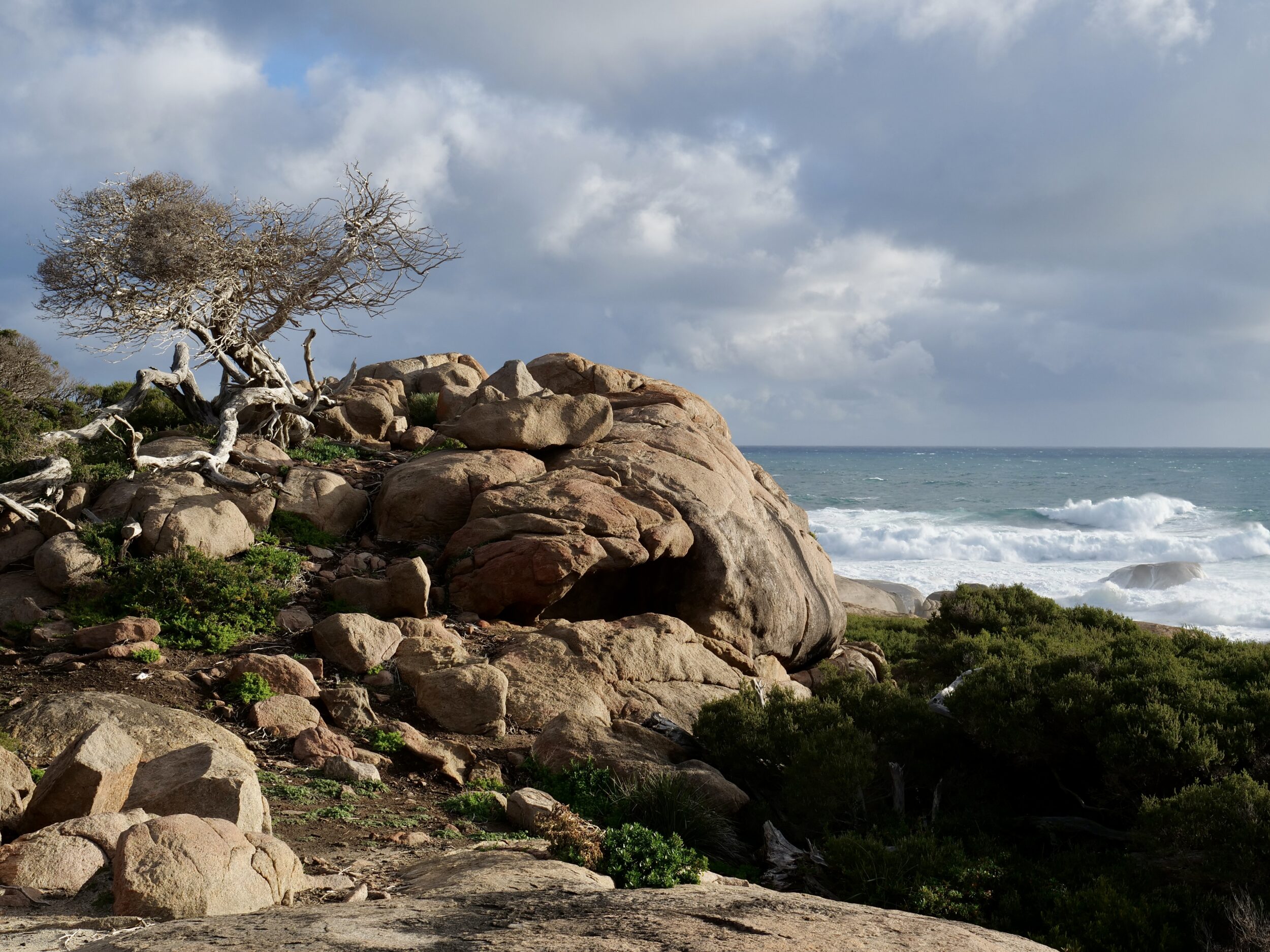
The photo shows one of our favourite coastal locations in the Margaret River region, as it was at 4. 42 pm on 21 August 2025.
Cape Freycinet is wonderfully wild, and presents a different “face” on each and every occasion.
It is also easily reached; the whole drive is 2WD- friendly and takes a deal less than one hour, mostly south along Caves Road, from Margaret River – or north along Caves Road, from Augusta.
Only the final few kilometres are unsealed.
Either way, one turns off Caves Road into the well-maintained Conto Road, adjacent to Lake Cave.
In straight-line distance, Cape Freycinet is circa 78 ks south of Cape Naturaliste and 33 ks north of Cape Leeuwin.
The latter is the Australian continent’s southwestern “corner”, but is not WA’s southernmost tip; for the next several hundred kilometres, as one heads east, the WA coastline extends further south until it reaches West Cape Howe, between Denmark and Albany.
The “Two Capes”/ “Cape to Cape” walking track is accurately named; it runs north-south along the western shoreline, visible below.
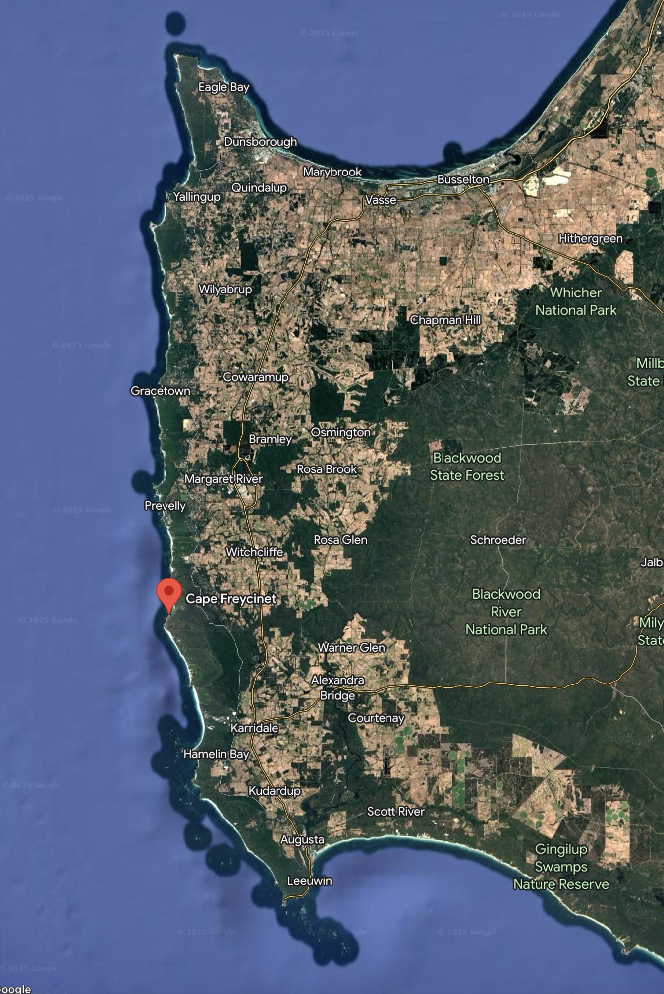
The northern cape (northwest of Eagle Bay) is Cape Naturaliste.
The southern is Cape Leeuwin.
Naturaliste and Leeuwin are the “Cape to Cape” region’s only actual capes.
“Cape Freycinet” is merely a point.
All three names are reminders that Western Australia very nearly became a French colony, rather than a British one.
This little series’ next and final chapter shows two of Cape Freycinet’s ever-changing “faces”.