#6 in this series looked out to sea, from a bay on the western side of the Coromandel Peninsula – a popular “weekend escape” destination for many residents of Auckland.
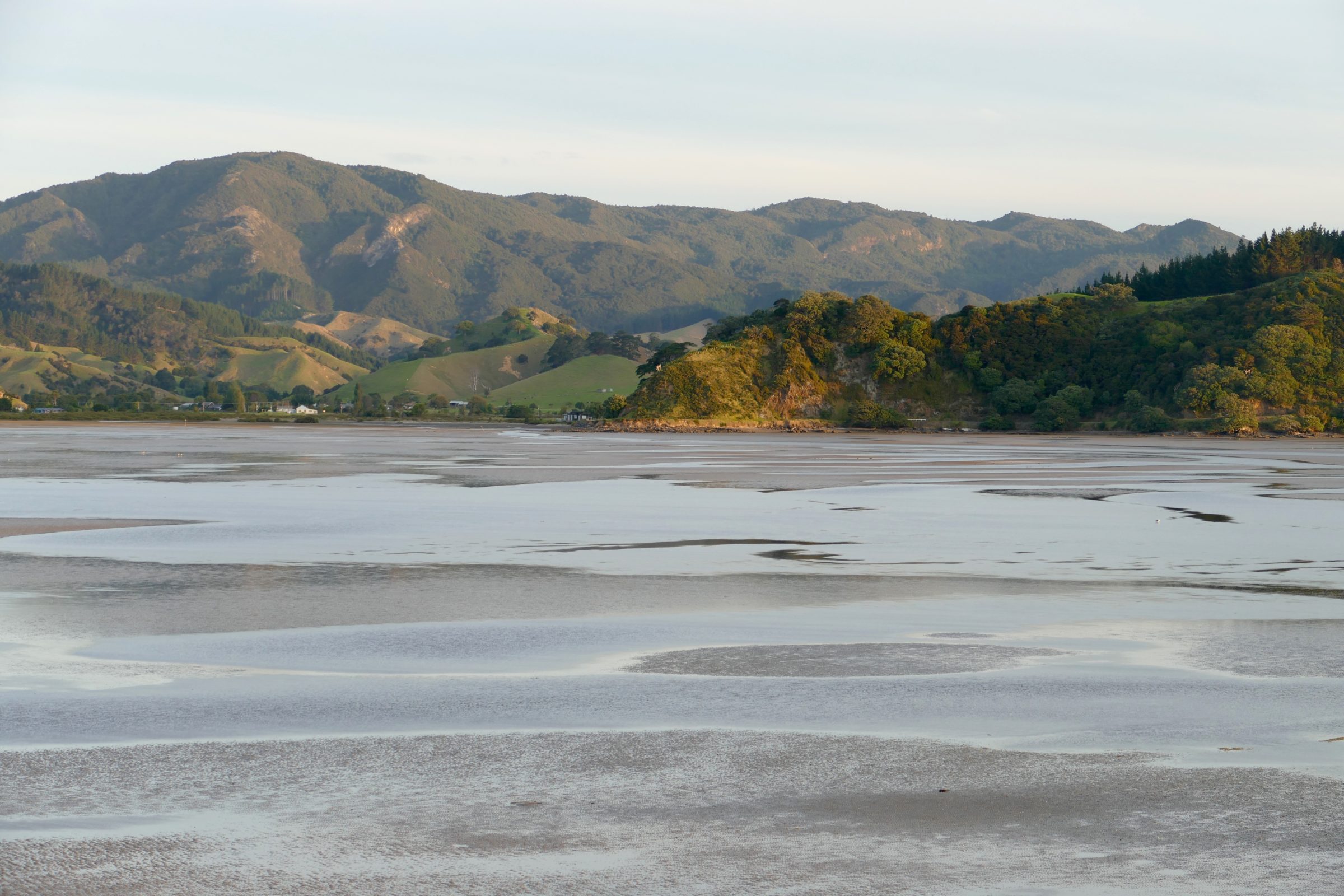
This post’s featured image was taken from almost exactly the same spot, but looking into a bay whose waters were very much deeper two centuries ago.
Captain Cook and his crew, in 1769, were probably the first Europeans to see the Coromandel Peninsula.
Then, as was true of most of New Zealand at that time, temperate rainforest clad the Peninsula’s steep slopes.
Europeans settled there, from the 1830s on, but by the late 1700s European seafarers had already begun to “harvest” the Coromandel’s Kauri trees, mostly for masts and spars on British naval vessels.
New Zealand’s first humans had arrived only several hundred years earlier; strangely under-recognised are two key facts: that NZ was the last substantial, habitable place on Earth to be peopled, and that the Maori had already wreaked a deal of environmental devastation upon NZ before Europeans arrived.
The devastation of the Coromandel’s forests (and NZ’s, generally) was, however, very much a consequence of the Europeans’ arrival, and their appetite for timber, for gold, and for (cleared) pastures.
Within a couple of decades, most of the Coromandel’s Kauri trees were gone: circa 200,000 hectares of forest were reduced to circa 5,000 hectares.
Circa one billion cubic feet of timber were removed.
The Coromandel’s already naturally high erosion rate then went “ballistic”; many millions (billions?) of tonnes of soil was lost.
Pre-1795, if a sailing ship had arrived in a bay such as the one pictured, chances are that it could have sailed right into the bay, and anchored within a few metres of its innermost shore.
Such bays are now filled with what once were the Peninsula’s topsoils.
Today, no substantial ship can sail into them, and at low tide much of these bays’ “waters” are exposed sandflats/mudflats.
Previously “impossible” for mangroves, these bays have become eminently suitable habitat.
(if you zoom in on the far shore in the featured image’s left side, you can see it is in the process of being “colonised” by mangroves)
Ironically, at least on the northern half of the North Island, one consequence of the wholesale destruction of so much of New Zealand’s rainforests is the ongoing expansion of NZ’s “tidal forest” cover.
Many New Zealanders (and not just New Zealanders) do not understand what is happening; they fail to distinguish between cause and symptom, they hate mangroves, they wrongly perceive them as “alien invaders”, as “monsters who turn lovely beaches into stinking mess”, and they wish to eradicate them.
The next post will seek to explain why wholesale removal of mangroves would likely prove every bit as misguided and damaging as was the removal of most of NZ’s rainforests.
(photo is copyright Doug Spencer, taken at 7.51 pm on 6 March 2017)