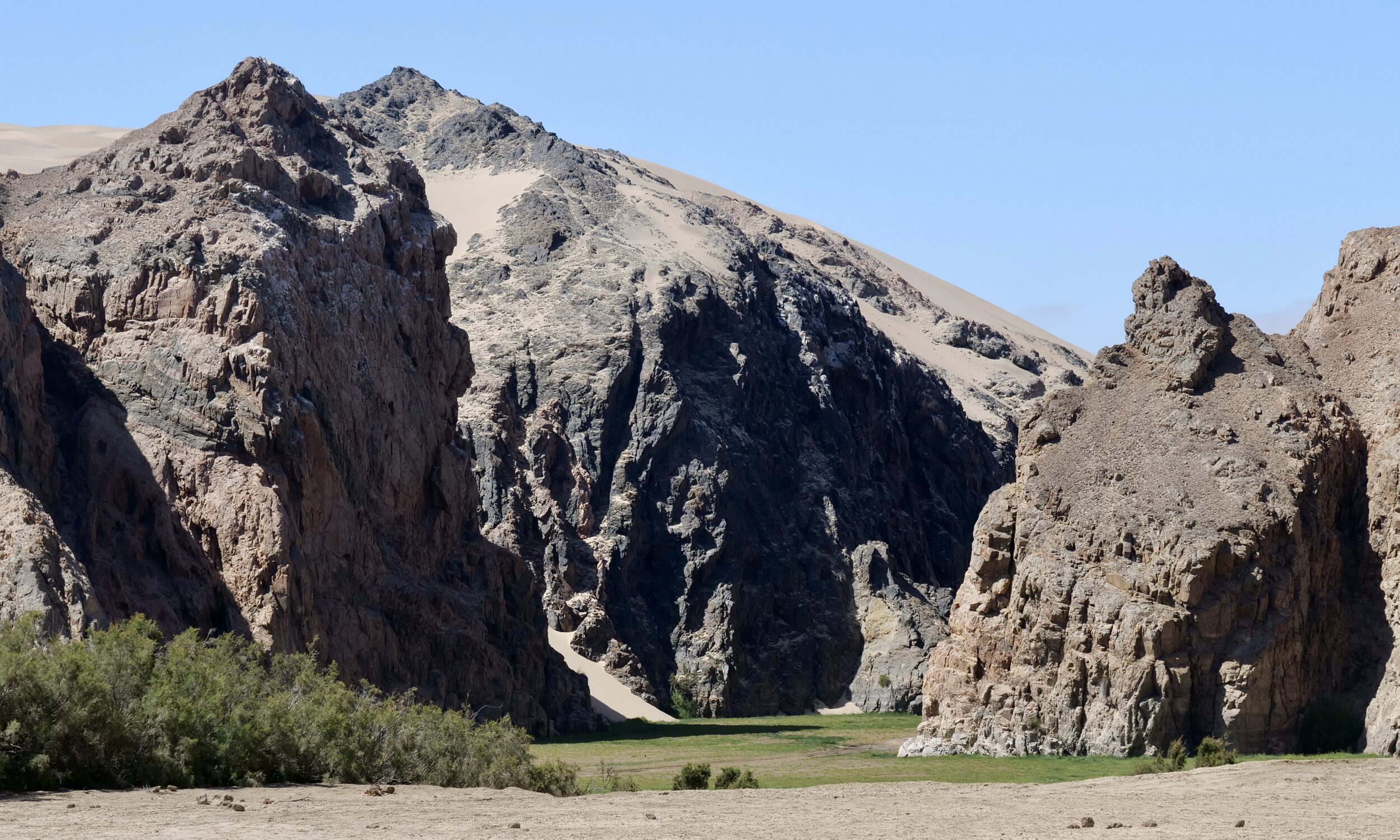
Absolutely nothing “artificial” is going on here, and you are indeed looking at one of the least-rainy places on our planet – a few kilometres in from the “Skeleton Coast”, on the Namib’s western edge.
Presumably/perhaps, there is a rock barrier below the dune on which I stood, at 10.24 am on 14 November 2022.
(dolerite “dikes” are a common landscape feature, above ground, in northern Namibia)
In any event, the “surprising” mini-forest in front of me could not survive on light and fog alone!
The trees must be accessing water, pooled, below.
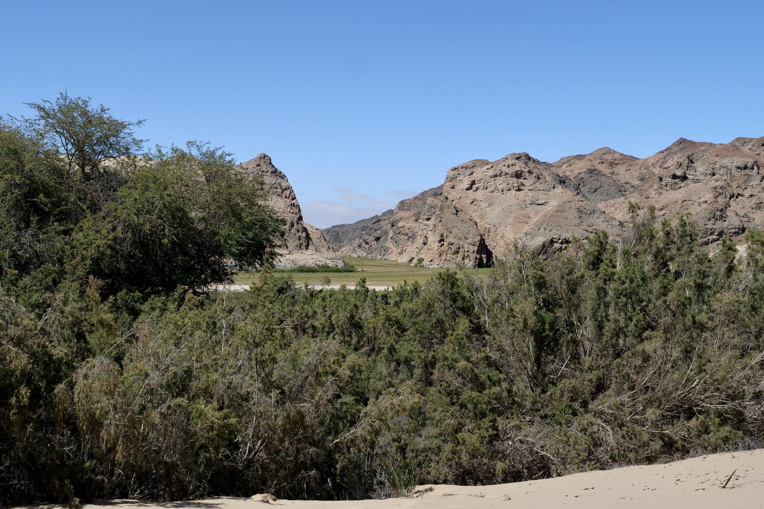
The rains that sustain these trees would have fallen well inland, in the mountainous upper reaches of the Hoarusib’s catchment – itself, by global standards, a relatively “dry” place with “unreliable” rainfall, but nonetheless many thousands of percent more rainy than the pictured location.
The featured image offers a wide-angle (32mm) view, whilst the one below deployed a short (120mm) telephoto lens.