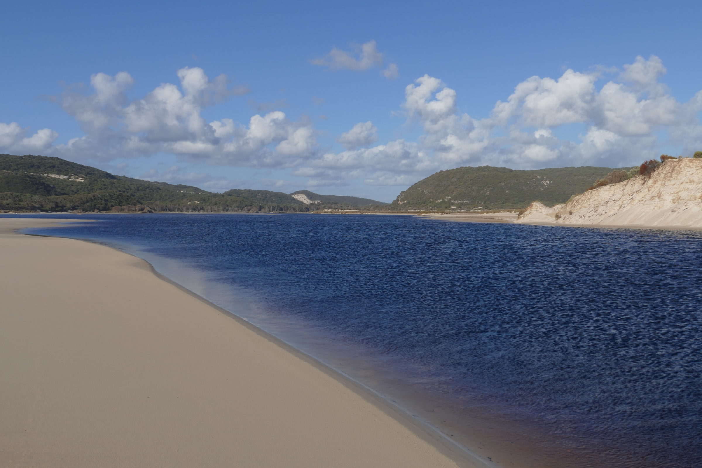
The featured image (all photos copyright Doug Spencer, 27 October 2016) was taken from Yeagarup Beach, circa 30 kilometres from Pemberton.
The Southern Ocean’s shore was just behind me, as I gazed across the Warren River’s lowermost section.
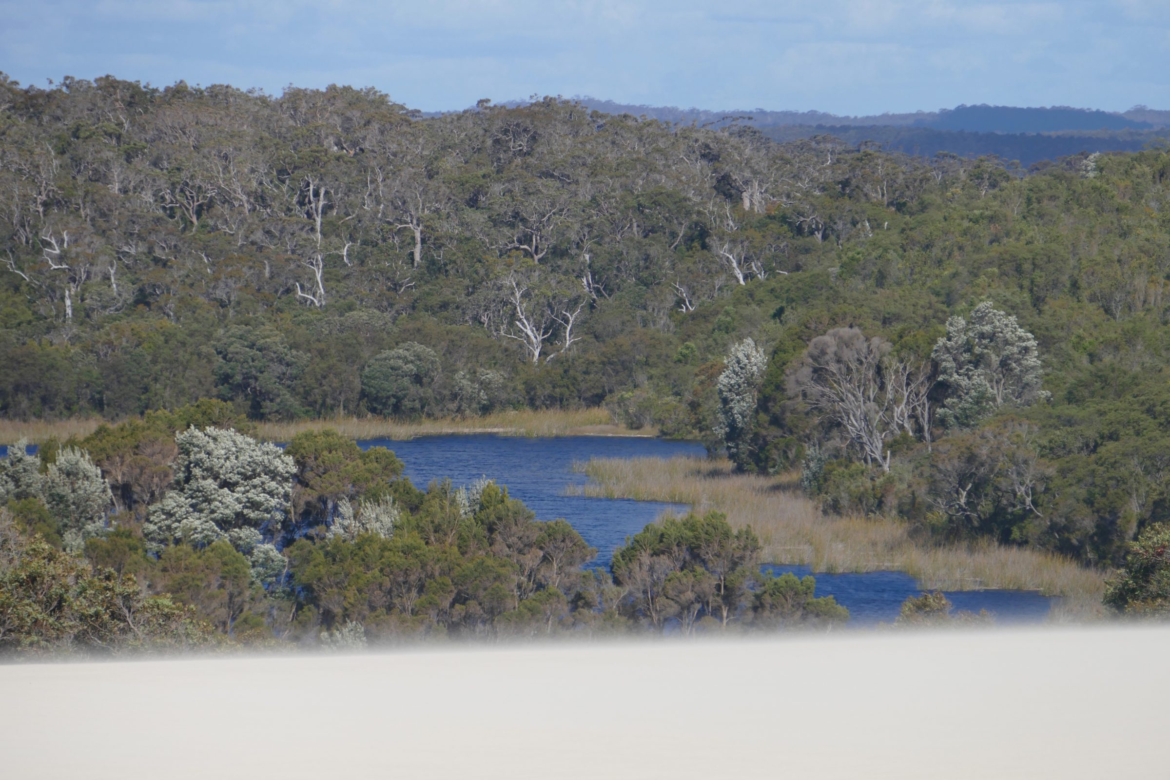
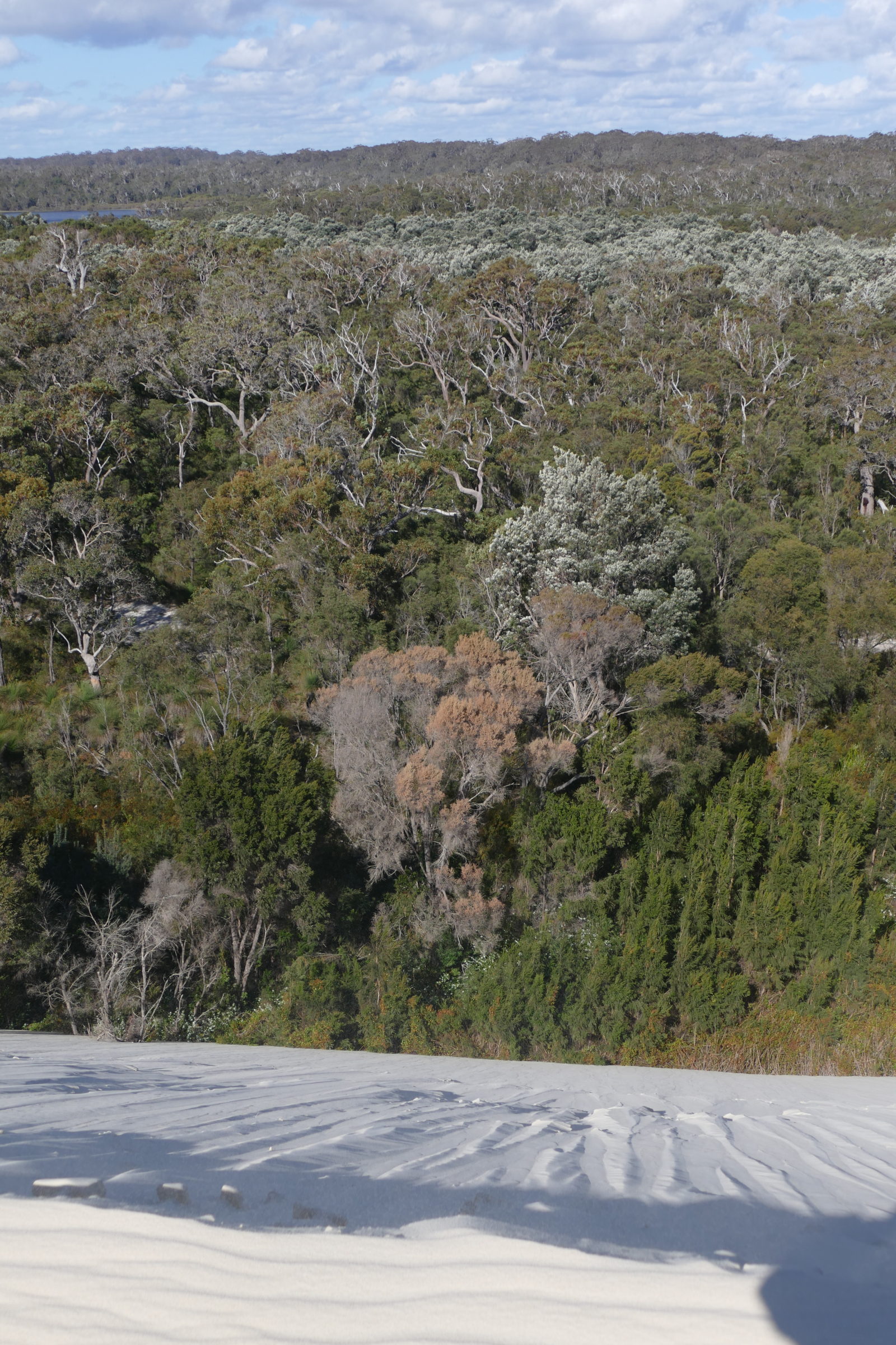
To get there, we had driven through some of Australia’s most beautiful “virgin” tall Eucalypt forest, then crossed the Southern Hemispere’s largest land-locked mobile dune system.
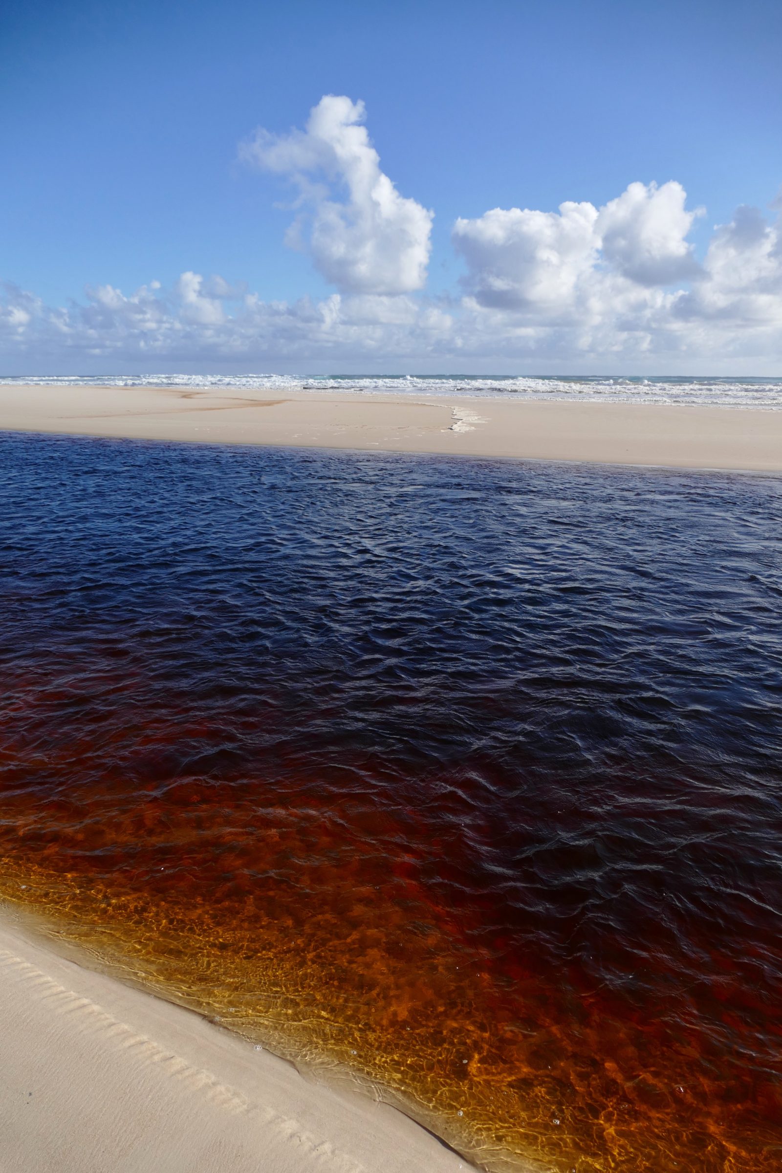
In Deep South WA – as distinct from WA’s southwest “corner” – the Warren is the biggest river, in terms of water volume.
( Southwest WA’s biggest river – the Blackwood – is bigger than the Warren, but also decidedly modest, in world terms. Where the Warren flows through the Warren National Park’s Karri-dominated forest is one of my favourite places. You can see why, here )
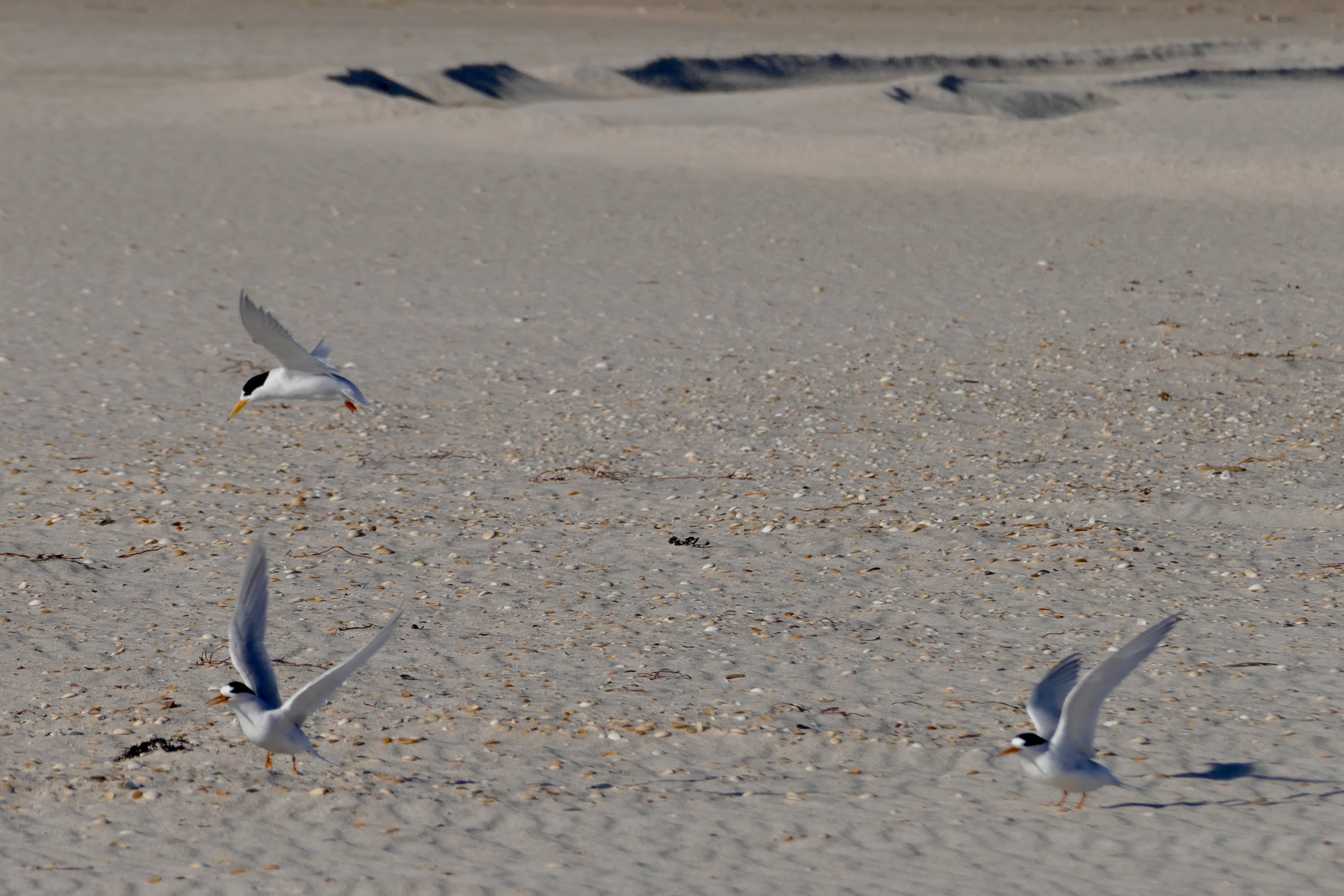
The superbly wild beach on which we stood that afternoon is a breeding place for Fairy Terns, so human visitors should take great care.
This place is the only location in this series which you cannot reach via a 2WD vehicle, plus a short walk.
Navigating the Yeagarup Dunes is a serious exercise – circa 40 minutes worth of skilful 4WD navigation, in each direction, or a demanding walk, a little more than six kilometres from Lake Yeagarup, then the same again, to Lake Yeagarup.
The best, convenient way is to let Pemberton Discovery Tours take you there; they are an excellent, environmentally responsible outfit, with capable, courteous, well-informed staff.
We have several times enjoyed half-day trips with them; if one of your party happens to be aged, a little frail, or timid, or physically handicapped, just let PDT know so, and – as we know, from personal experience – everyone “on board” will be safe and treated well..and no terns will be harmed.
The Yeagarup Dunes are “eating” forest, as they advance inland, circa 4 metres per year.
Discover more, here.
This series’ next chapter takes us to Point D’Entrecasteaux, which is not so very much further east, along the Southern Ocean’s shoreline.
It is, however, a considerably greater distance, by car – for the most part, D’Entrecasteaux National Park is a place uncut by roads.