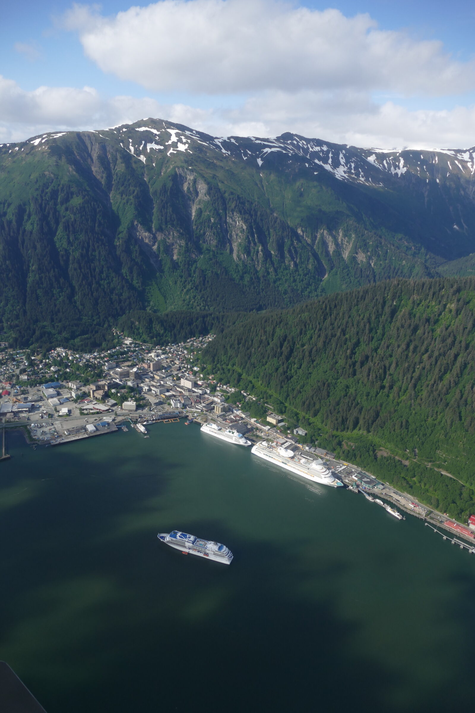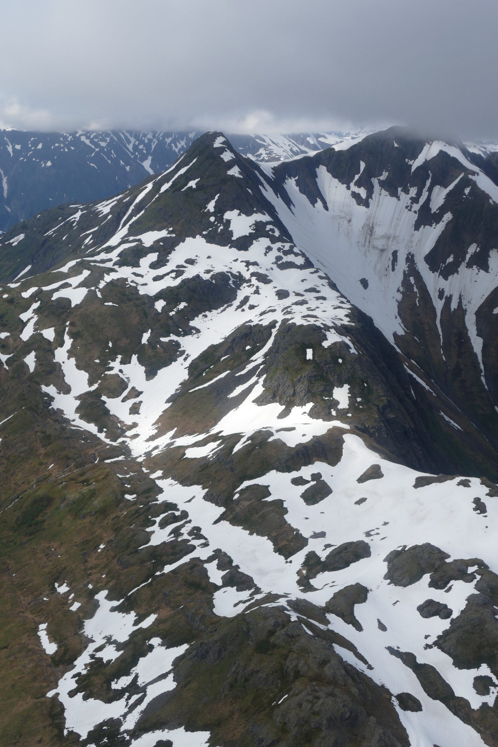
This post’s photo was taken just three minutes after the previous one’s.
Circa five minutes earlier, our float plane had lifted off from Juneau’s Gastineau Channel.
One CommentNatural splendour, real musics, wines, wordpower
This post’s photo was taken just three minutes after the previous one’s.
Circa five minutes earlier, our float plane had lifted off from Juneau’s Gastineau Channel.
One Comment
On the afternoon of 24 May 2015 “our” floatplane took off from the Gastineau Channel – the fiord adjacent to Alaska’s capital city.
Juneau is a surprising place, as is true of all of the low-lying, coast-adjacent terrain on southeastern Alaska’s “panhandle”.
This “strip” is not a cold place, by northern North American standards, at least.
Snow falls are infrequent, usually modest. Much of the natural vegetation is temperate rainforest.
In “the season”, cruise ships disgorge huge numbers of tourists onto Juneau’s tourist-tacky foreshore.
In terms of permanent residents, however, Alaska’s capital city is a small town; if it were in China, it would be a “village”.
Australia calls the likes of Mount Gambier, Albany, and Bathurst “cities”; Juneau is a little more populous than “The Mount”, but a deal less so than Albany or Bathurst.
Juneau is unique among capital cities in one crucial respect: no roads connect it to anywhere more than a few kilometres distant.
The mountains and glaciers just inland of “the strip” are so formidable that all visitors – and all supplies – reach Juneau via sea or air.
Comments closed
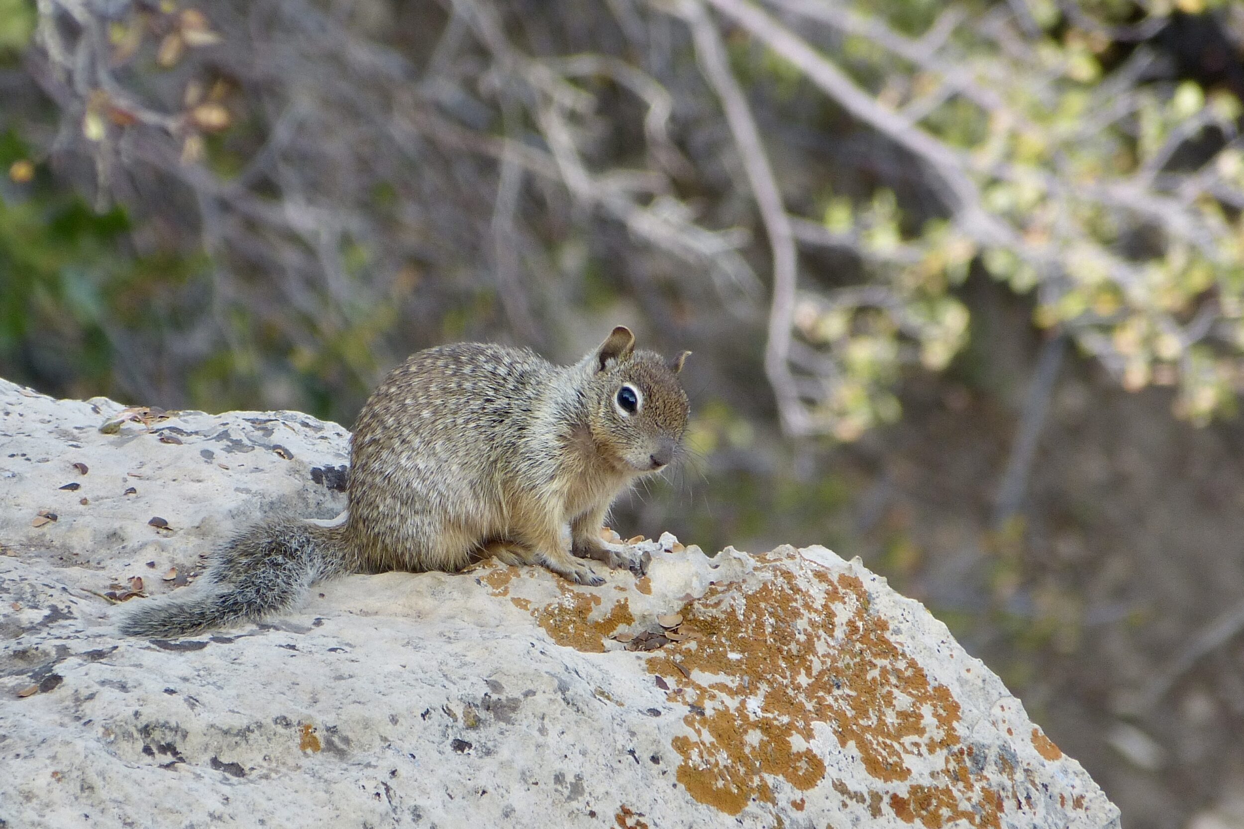
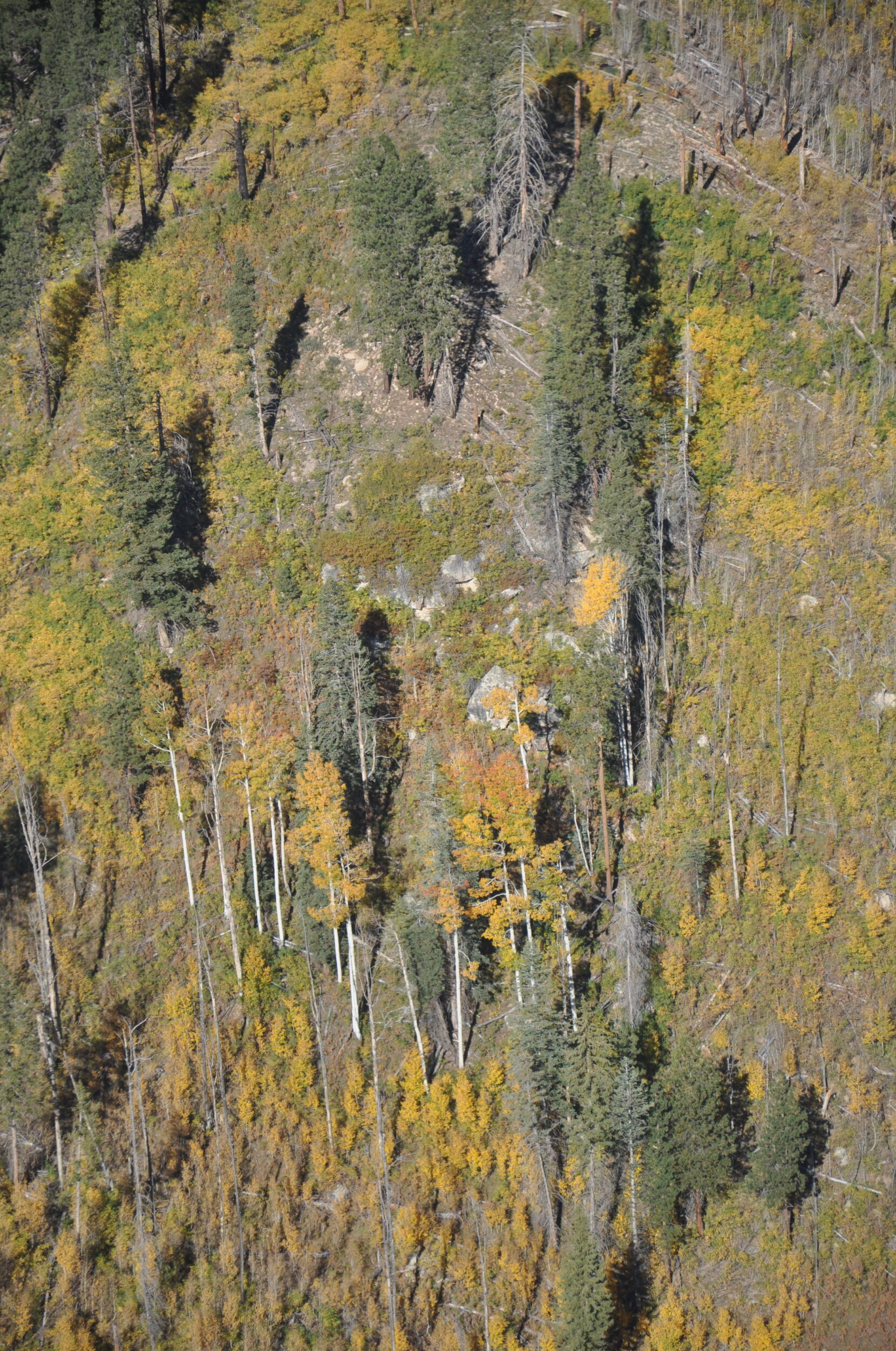
When in an “epic” landscape such as The Grand Canyon, one should always remember to look at the “near views” as well as the grand vistas.
However jaw-dropping it is to look down 1.6 vertical kilometres to the Colorado, there is every chance that something else – something equally worthy of your attention – sits within a couple of metres of your nose…on the ground at your feet.
Comments closed
This post’s photos were taken within the space of circa sixty seconds, on the autumn morning of October 8, 2012.
In the unlikely event that one had never previously seen any images of the Grand Canyon, it would be easy to believe that this post’s and the immediately-preceding post’s photos were taken in two entirely different canyons.
Comments closed
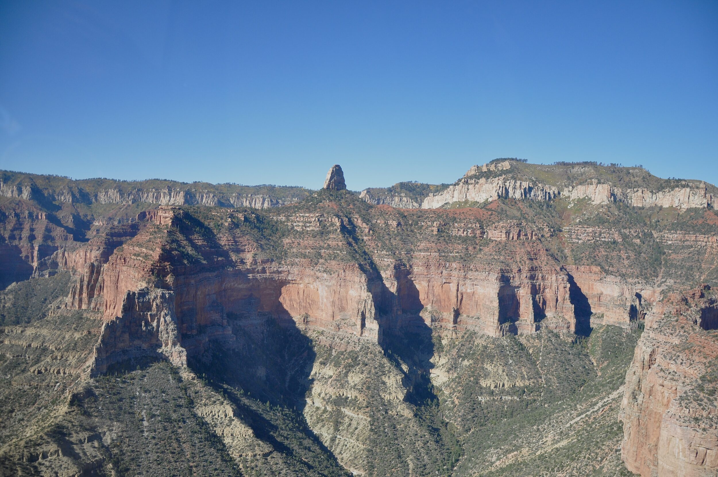
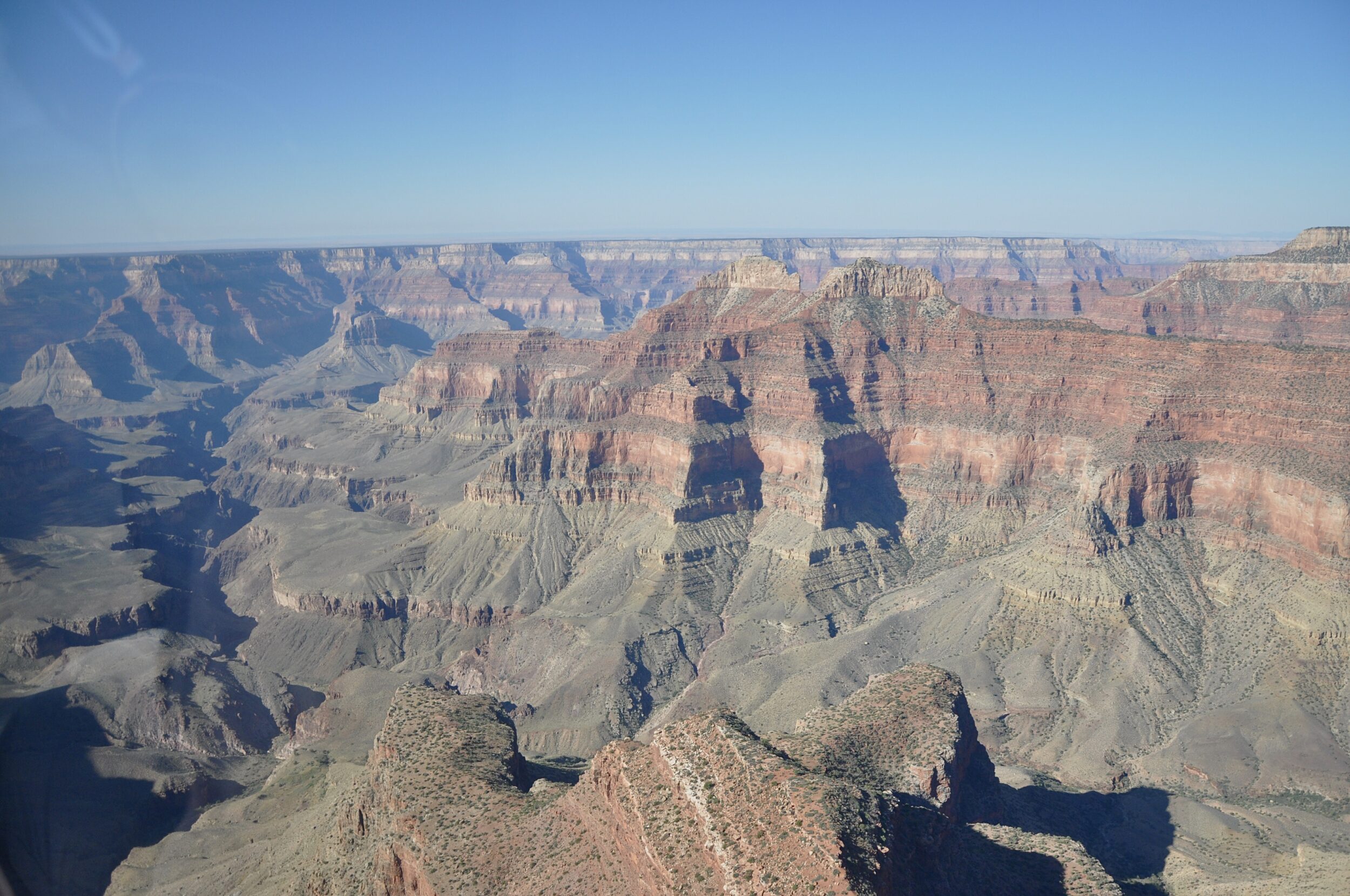
Our early autumn morning helicopter flight in October 2012 made it easy for us to see how very different were the Grand Canyon’s North Rim and South Rim.
The average “straight line” distance from South Rim to North Rim: 16 kilometres.
Maximum straight line distance: 28.8 kilometres.
However, the road distance from South Rim Village to North Rim Village is 346 kilometres; given favourable weather, a car’s driver should allow five hours!
Comments closed
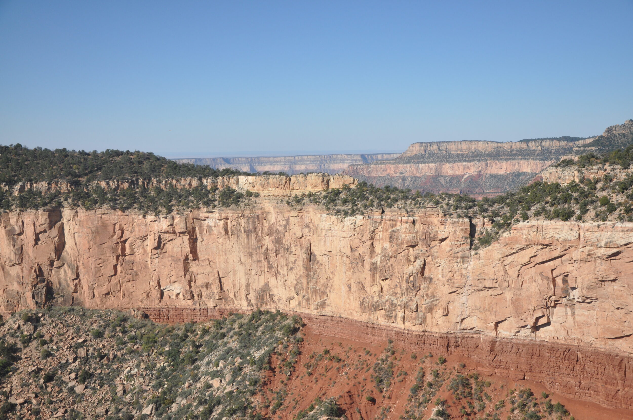
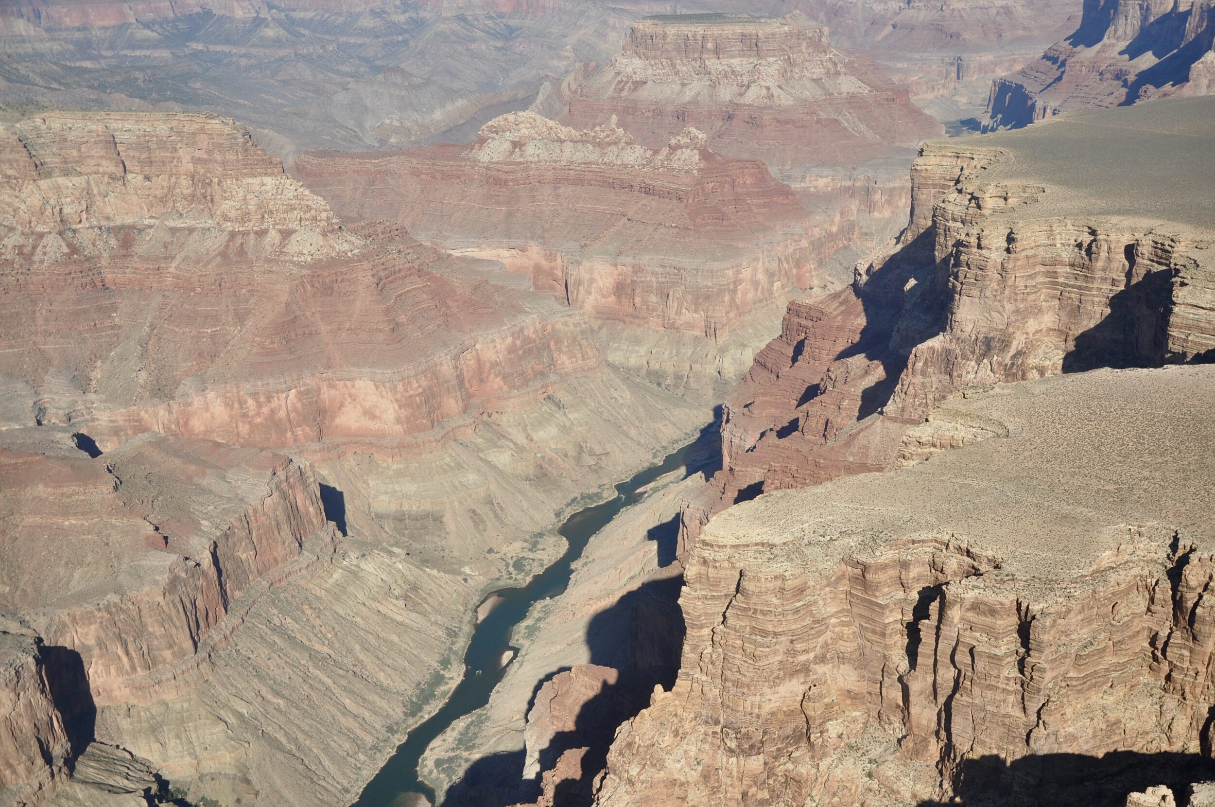
The Grand Canyon’s primary “sculptor” – the Colorado River – is on the left hand side of the image.
From this October 2012 photo’s helicopter vantage point, the Colorado’s waters were rendered invisible by early morning shadows, but the river’s course was readily apparent.
As you would expect, the Grand Canyon National Park’s “stats” are impressive; click here to see many of them.
Comments closedThe first three of this post’s four photos were all taken from a helicopter, looking down into the Grand Canyon.
That canyon’s “lead author” runs along its “floor” – the Colorado River.
As the Colorado’s excellent Wikipedia entry notes, the United States’ fifth-longest river is one of the most controlled and litigated river systems in the world.
This once-wild, formerly much-mightier river has become an ailing shadow of its former self; irrigators and thirsty cities have tamed, maimed and nearly drained it.
One Comment
One of the world’s most famous, most oft-photographed natural attractions can still greatly surprise even an allegedly “well-informed” first-time visitor.
This post’s photos were both taken from a helicopter, looking down at the northern “wall” of what many humans (wrongly) believe is “our” planet’s biggest and/or deepest canyon.
The Grand Canyon is neither the biggest in volume, nor the deepest, nor the longest, nor the widest, but it is very grand.
Some parts of the Grand Canyon are a deal “leafier”, cooler, and wetter than most people imagine.
Comments closed
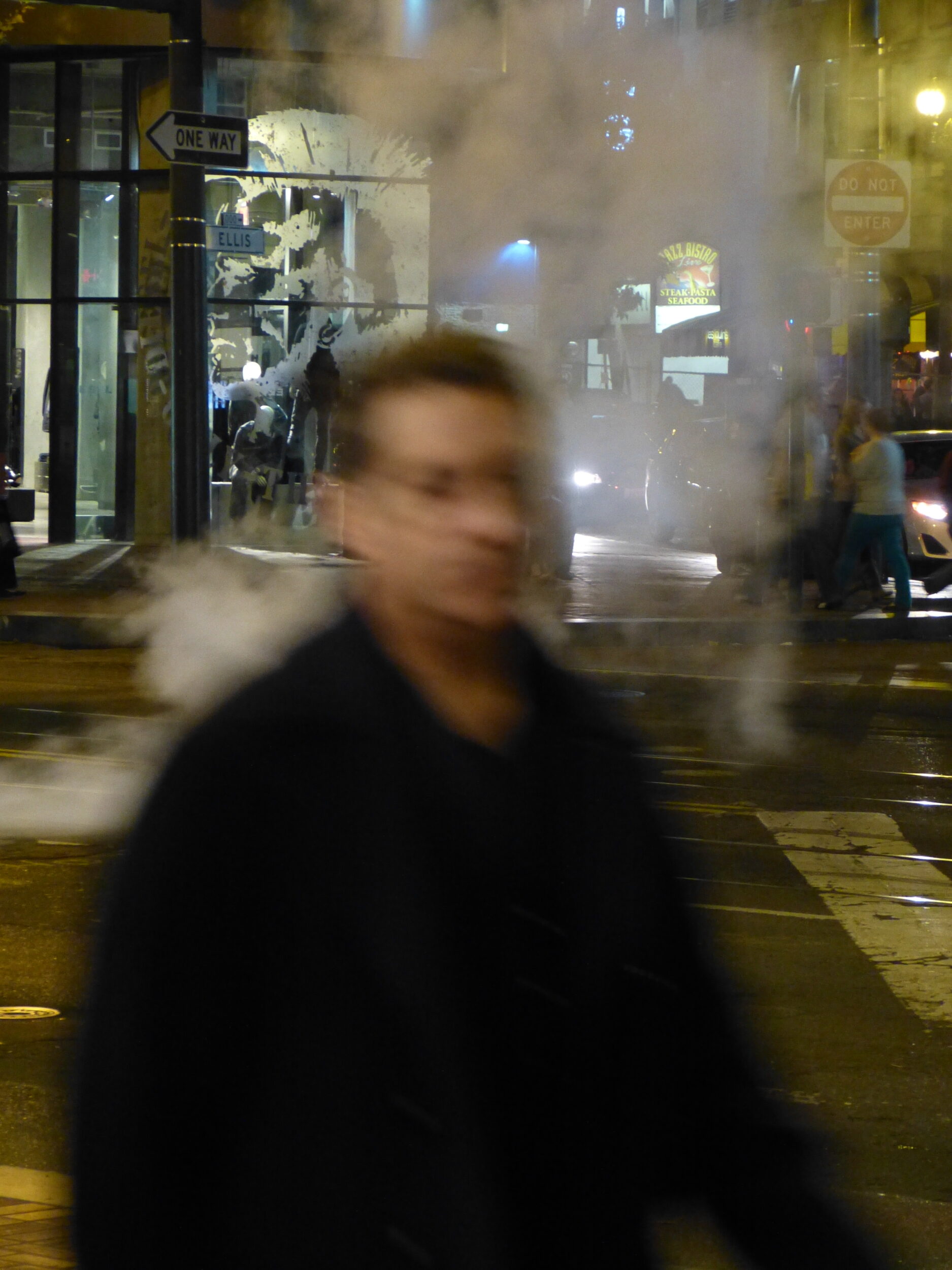
This post’s photos were not “manipulated”.
They were single-exposures, taken in available light (no flash) with a hand-held camera, on or near Market Street, San Francisco on the night of 14 October 2012.
We had not stumbled upon the shooting of a scene for a “major motion picture” of the ghostly, supernatural, or steampunk kind.
It was just another normal autumn night in ‘Frisco – if one accepts that any urban-Californian night can ever be normal.
There is a non-supernatural explanation for the “surreal” appearance of some of this city’s central streets, most especially on chilly nights.
Comments closed
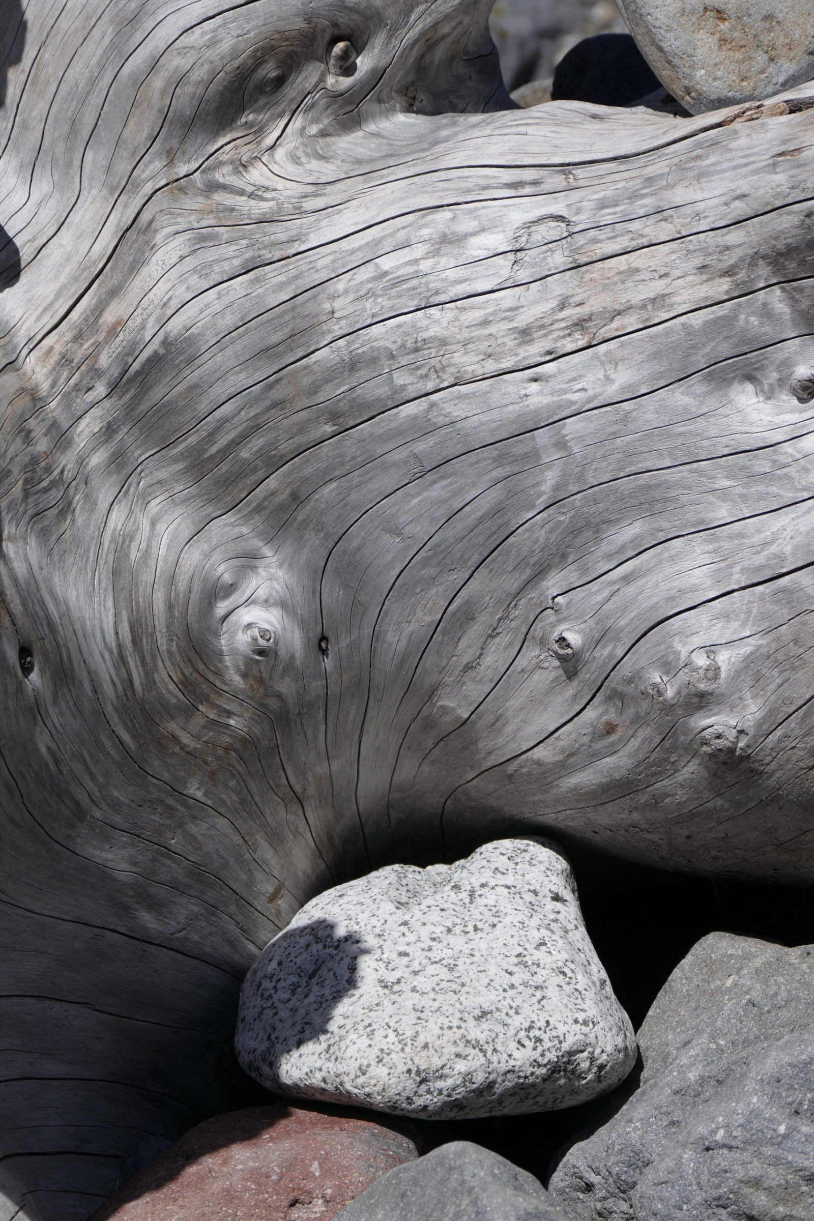
On 9 June 2015 the relevant part of the glacier and snowmelt-fed riverbed was bone dry.
But when the river rages, it uproots mighty trees, carries them for a while, then dumps them
Then, over many years, the consistently shifting, ever-swelling/shrinking river transforms their “skeletons”.
Comments closed