Its paradoxical nature is nowhere more spectacularly evident than at Second Valley – a South Australian “secret”…and a geological marvel.
(photos copyright Doug Spencer, all taken around midday at Second Valley, December 24, 2017)
On the western side of The Fleurieu Peninsula, and thereby on the eastern shore of Gulf St Vincent , Second Valley is 90 kilometres south of Adelaide.
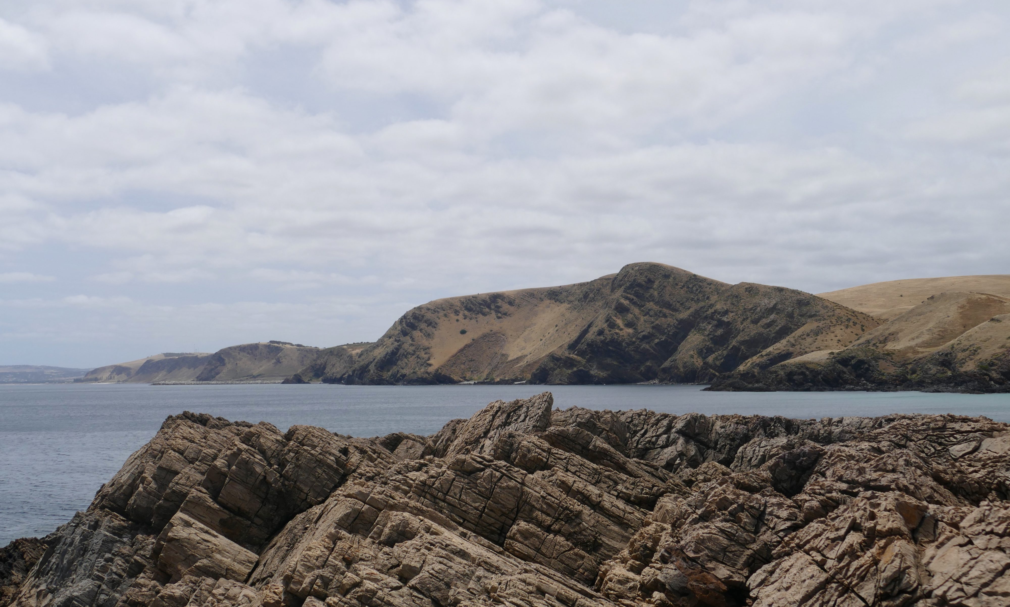
The photo atop this post looks north, toward Normanville.
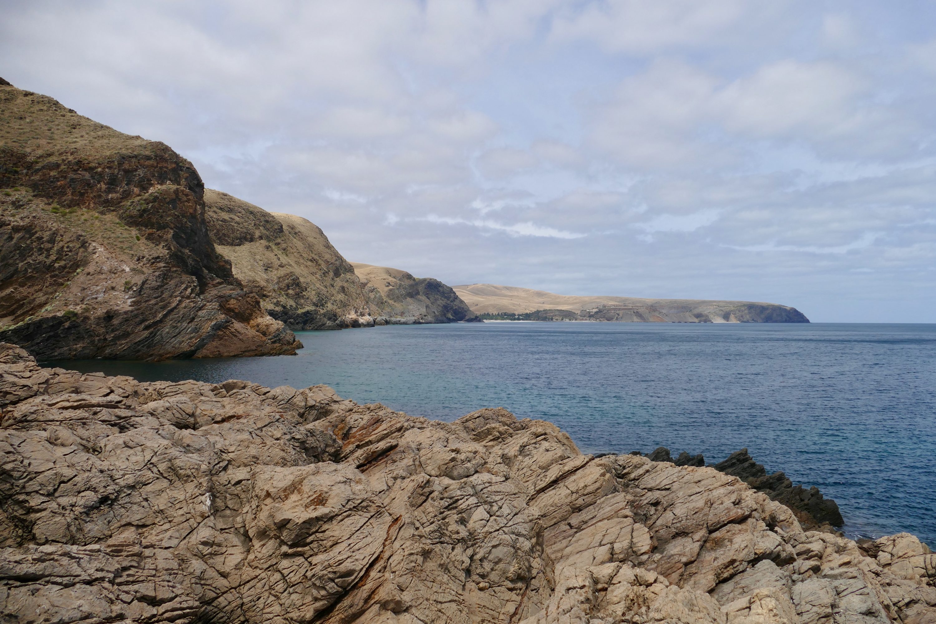
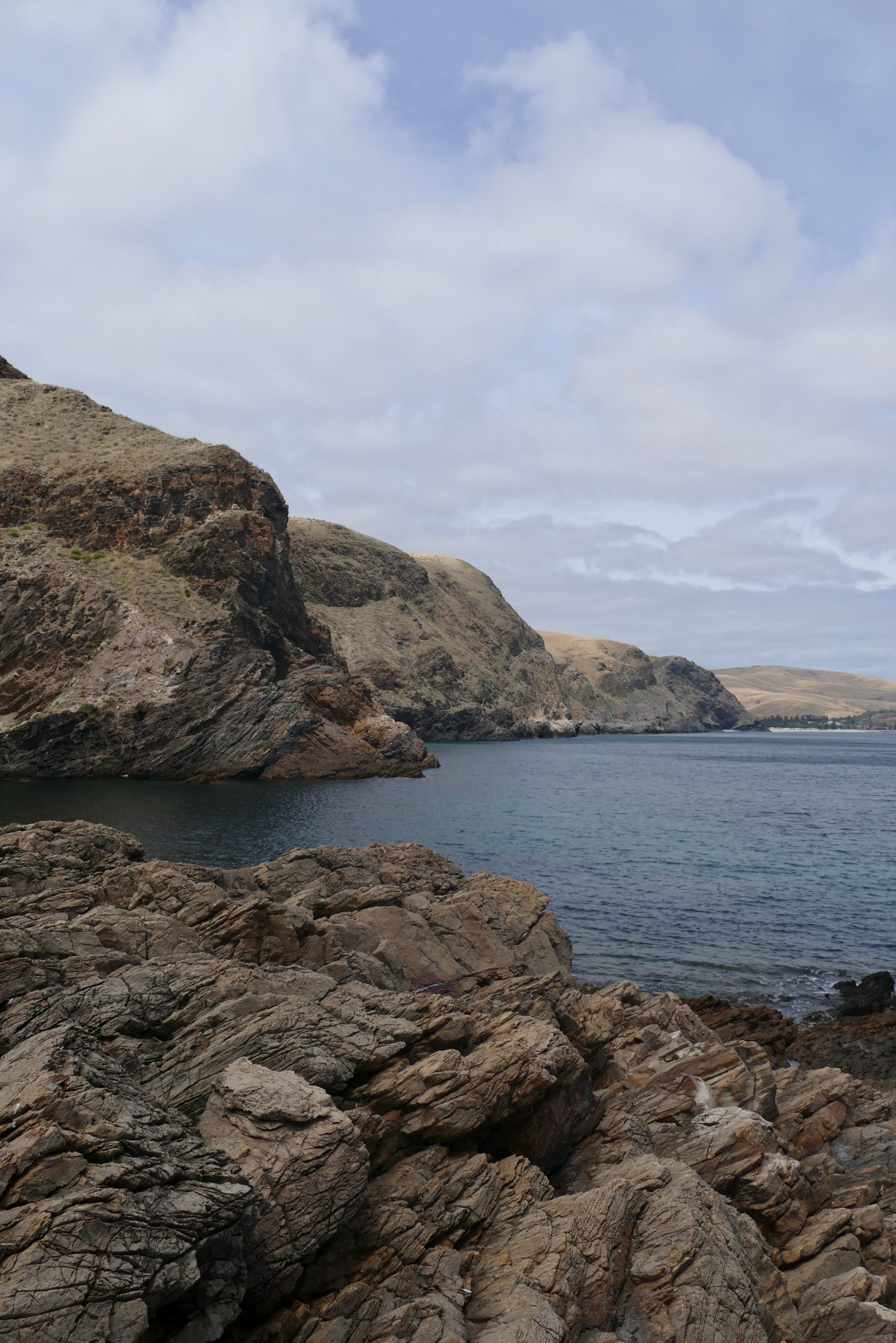
These look south toward Rapid Bay.
Today, the Fleurieu is characterised by modest, mostly-rounded hills, and mostly-gentle valleys.
500 million years ago this peninsula was dominated by a new mountain range of Himalayan proportions.
Severe erosion over the next 200 million years saw their oldest, deepest rocks exposed, on the surface.
Its shorelines are very varied…and their current version is astonishingly young.
Some sandy beaches are lapped by mostly-placid waters, others by often-wild waves.
Other beaches are pebbled.
Some are backed by extravagantly coloured, obviously-eroding, ochre-rich cliffs.
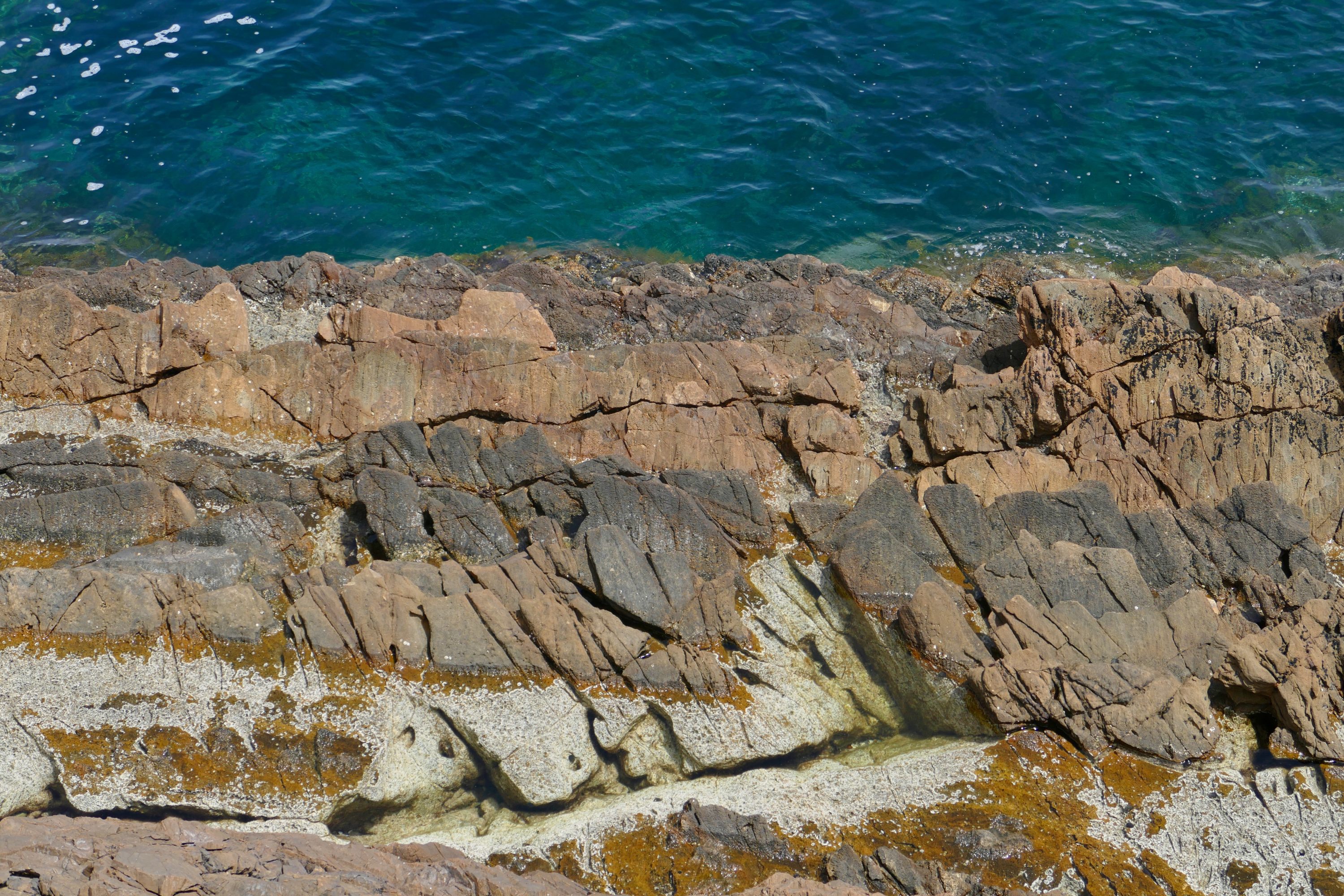
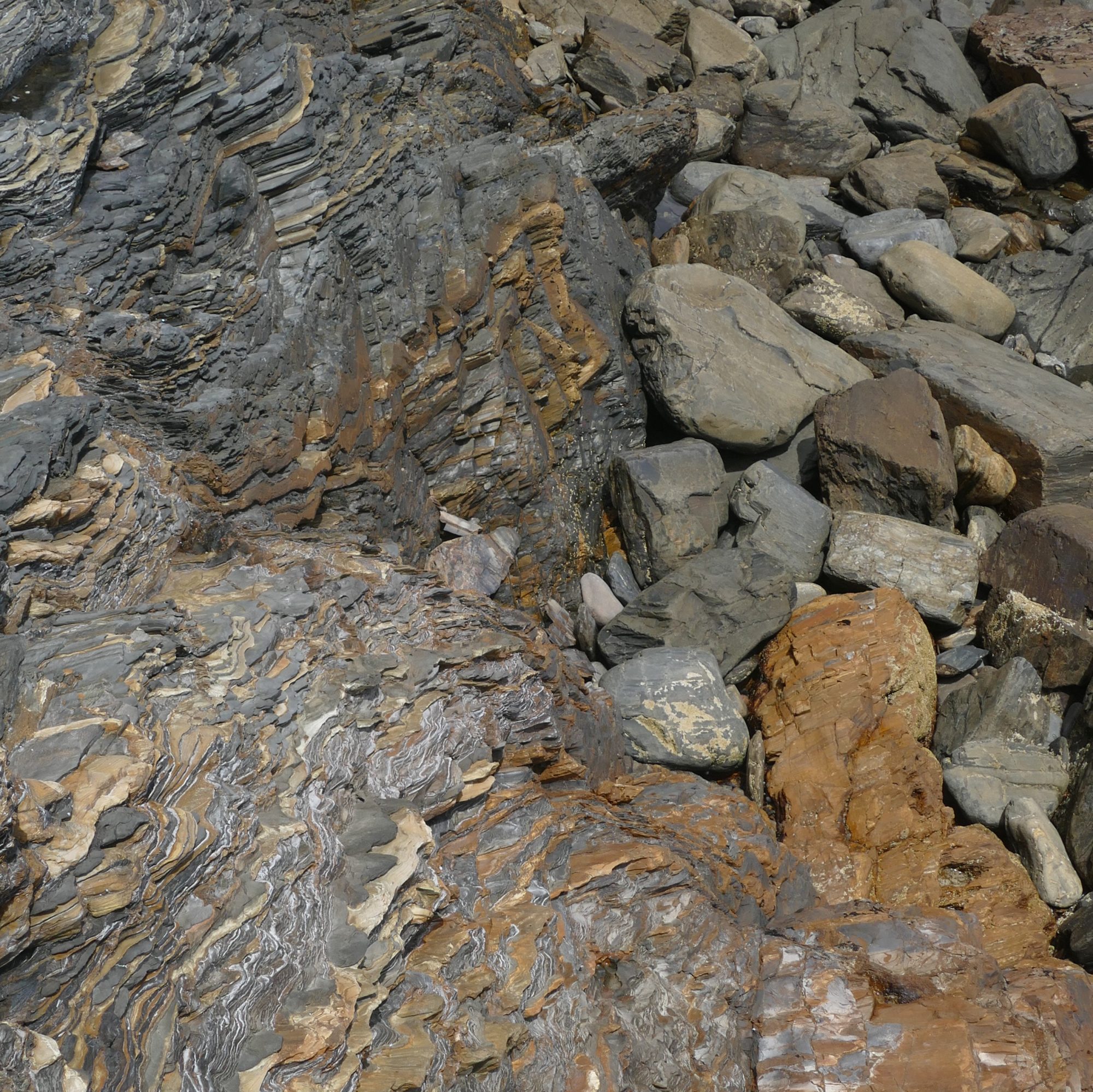
In some places there is no beach; much tougher cliffs tumble directly into the sea, or overlook great “sheets” of rock.
Less than five minutes walk from the beachless shoreline pictured above are the eminently-swimmable, family-friendly, sandy-bottomed waters of Second Valley’s beach.
An ice sheet of Antarctic proportions – and 1,000 to 2,000 metres thick – once covered the Fleurieu.
When you walk along a Fleurieu beach, the sandgrains under your feet were probably sourced from glacial deposits.
As I took all this post’s photos – standing no more than a few metres above the water, or only a few more metres inland from it – everything looked “permanent”.
In fact, had I been there just 21,000 – twenty-one thousand – years earlier, the sea level would have been 125 metres lower than at present.
Land bridges would have allowed me to walk to Kangaroo Island!
Gulf St Vincent as we know it did not then exist.
Only 7,000 years ago did its present shorelines emerge, courtesy of rapidly melting glaciers.
But those shorelines are not actually “new”.
Over 2.6 million years of the Pleistocene – itself a blink of eye, geologically – sea levels fluctuated wildly…in that period they made the round trip to-fro “approx present” and “125 metres below” current sea levels around thirty times.
The general appearance/configuration of the Fleurieu’s watercourses is largely the product of just the last 125,000 years worth of sea level fluctuations.
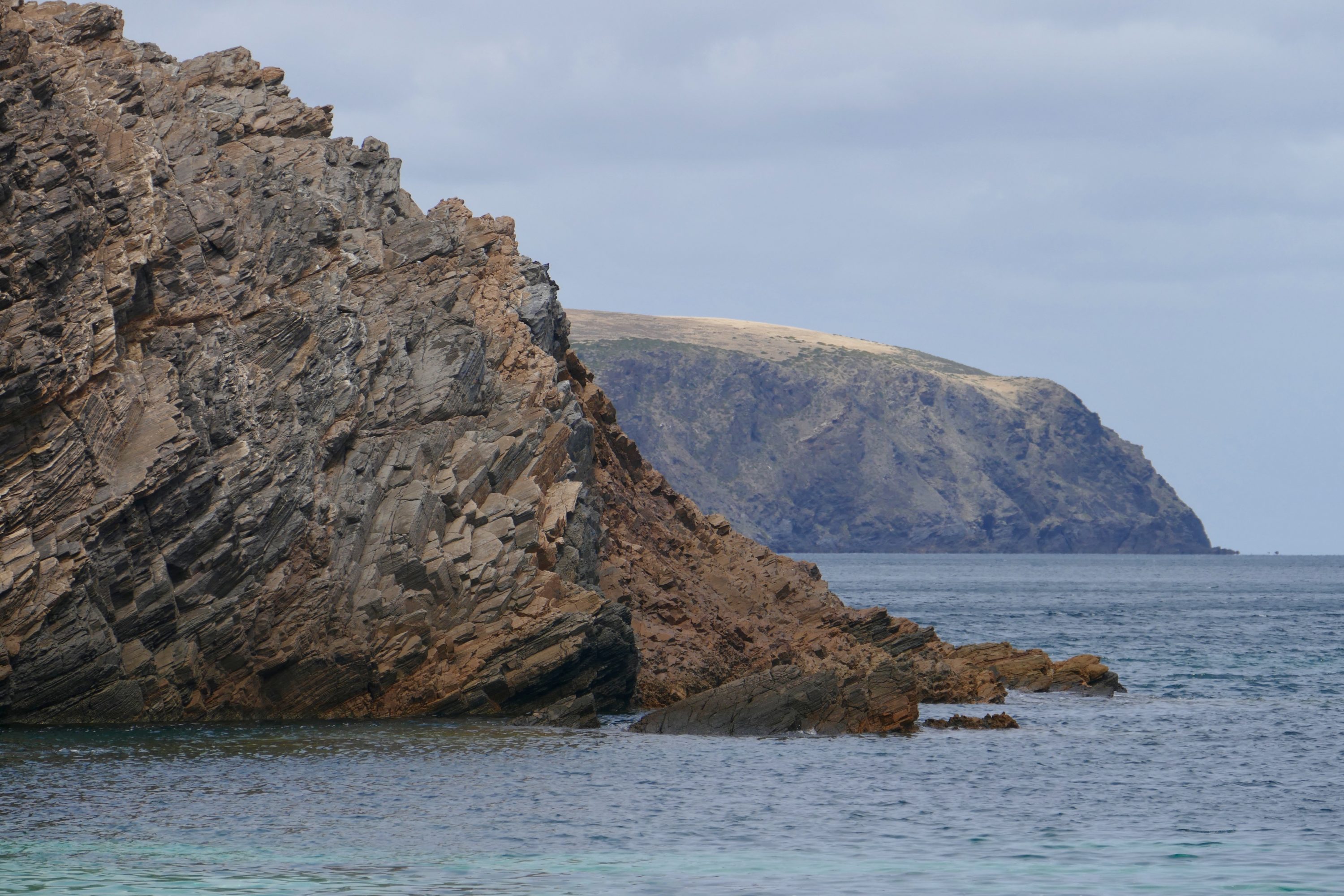
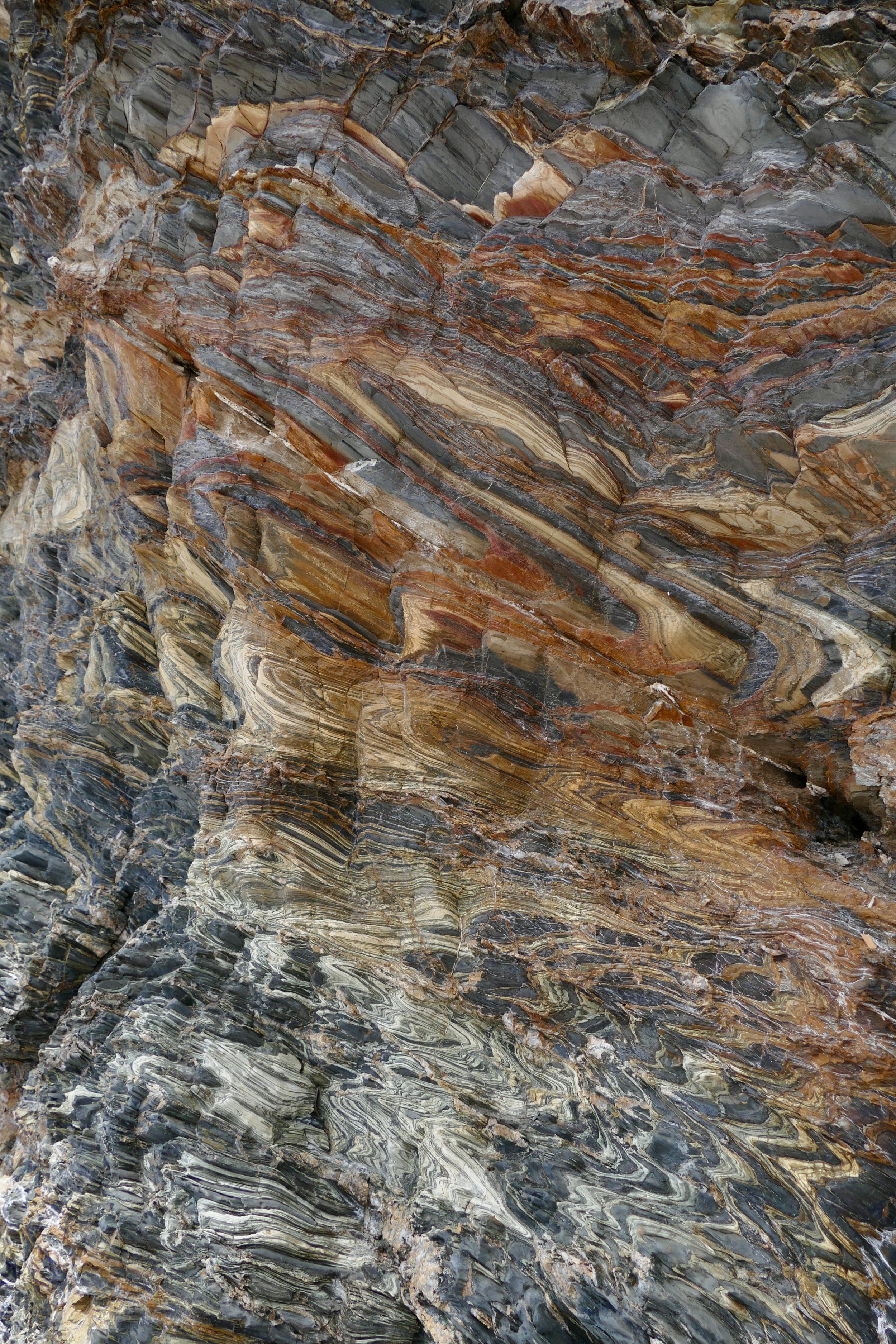
That said, stand beside the bottom of Second Valley’s cliffs and you can see and touch extravantly-contorted sediments that were originally “laid down” – flat – a great many million years ago.
This post is deeply indebted to the Fleurieu chapter in the freely-available electronic edition of Coastal Landscapes of South Australia, by Robert P. Bourman, Colin V. Murray-Wallace and Nick Harvey, published in 2016 by University of Adelaide Press.
The Fleurieu chapter is here
Wireless hill . Spent much of my childhood there amongst the abandoned buildings